
Magnitude |
3.3 |
| Date & Time (UTC) | 2013-06-06 16:50:54.5 |
| Date & Time (Local) | 1392/3/16 21:20:54.5 |
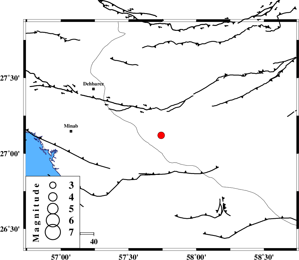
| Location | Lat:27.12 Lon: 57.74 |
| Region | Kerman Province, 41 km South-East of Manujan |
Nearest Cities |
|
| 17 km North West of Keshmiran, Kerman Province | |
| 40 km South East of Manujan, Kerman Province | |
| 45 km North East of Sanadrak, Hormozgan Province | |
| 47 km South West of Qalehy-eganj, Kerman Province | |
| 55 km North East of Koryan, Hormozgan Province | |
| Depth | 18 km |
| Agency | |
Faults within 150 km: |
|
| SABZEVARAN_F (Length: 190 km) , Distance to epicenter: 25 km | |
| JIROFT_F (Length: 144 km) , Distance to epicenter: 26 km | |
| ZENDAN_MINAB_F_Z1 (Length: 183 km) , Distance to epicenter: 48 km | |
| Number of Phases | 4 |
| RMS | 0 |
| Number of Stations | 4 |
| Error in Latitude | >3.5 km |
| Error in Longitude | 1.8 km |
| Error in Depth | 7 km |
Download waveform in seisan format
to download seisan software Click here
to access information about IIEES stations Click here
Amplitude | ||||||||
| UID | Agency | Station | Component | Amplitude | Period | Arrival Time | Proccessing Time | Signal Clip |
| 89567 | IIEES | KRBR | N | 84.3 | 0.48 | 2013-06-06 16:52:53 | 2013-06-06 06:39:00 | n |
Phase | ||||||||||||
| Agency | Station | Component | Phase Type | Phase Quality | First Motion | Observed Arrival Time | Time Residual | Loc. Flag | Input Weight | Distance | Azimuth | |
| IIEES | BNDS | Z | P | E | 2013-06-06 16:51:20 | 0.01 | y | 159 | 282 | |||
| IIEES | CHBR | Z | P | E | 2013-06-06 16:51:41 | 0.02 | y | 321 | 121 | |||
| IIEES | ZHSF | N | P | E | 2013-06-06 16:51:52 | -0.07 | y | 406 | 46 | |||
| IIEES | ZHSF | E | Sg | E | 2013-06-06 16:52:47 | 0.04 | y | 406 | 46 | |||