
Magnitude |
2 |
| Date & Time (UTC) | 2013-06-06 20:57:16.8 |
| Date & Time (Local) | 1392/3/17 01:27:16.8 |
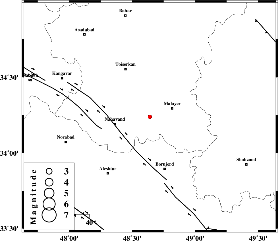
| Location | Lat:34.24 Lon: 48.64 |
| Region | Hamedan Province, 18 km West of Malayer |
Nearest Cities |
|
| 7 km North of Saman, Hamedan Province | |
| 7 km of Hoseynabad-e nazem, Hamedan Province | |
| 11 km North of Kahakdan, Hamedan Province | |
| 14 km West of Mehrabad, Hamedan Province | |
| 15 km East of Avarzman, Hamedan Province | |
| Depth | 42 km |
| Agency | |
Faults within 150 km: |
|
| NAHAVAND_F (Length: 102 km) , Distance to epicenter: 24 km | |
| SAHANEH_F (Length: 77 km) , Distance to epicenter: 36 km | |
| DORUD (Length: 100 km) , Distance to epicenter: 50 km | |
| Number of Phases | 6 |
| RMS | 0.1 |
| Number of Stations | 3 |
| Error in Latitude | >2.3 km |
| Error in Longitude | 1.6 km |
| Error in Depth | 11.1 km |
Download waveform in seisan format
to download seisan software Click here
to access information about IIEES stations Click here
Amplitude | ||||||||
| UID | Agency | Station | Component | Amplitude | Period | Arrival Time | Proccessing Time | Signal Clip |
| 89573 | IIEES | KHMZ | N | 29.3 | 0.28 | 2013-06-06 20:57:58 | 2013-06-07 02:17:00 | n |
| 89574 | IIEES | KHMZ | E | 25.8 | 0.15 | 2013-06-06 20:57:59 | 2013-06-07 02:17:00 | n |
Phase | ||||||||||||
| Agency | Station | Component | Phase Type | Phase Quality | First Motion | Observed Arrival Time | Time Residual | Loc. Flag | Input Weight | Distance | Azimuth | |
| IIEES | ASAO | Z | Pg | E | 2013-06-06 20:57:39 | 0.09 | y | 132 | 75 | |||
| IIEES | ASAO | E | Sg | E | 2013-06-06 20:57:55 | -0.05 | y | 132 | 75 | |||
| IIEES | KHMZ | Z | Pg | E | 2013-06-06 20:57:39 | 0.01 | y | 135 | 114 | |||
| IIEES | KHMZ | N | Sg | E | 2013-06-06 20:57:56 | -0.01 | y | 135 | 114 | |||
| IIEES | SNGE | Z | Pg | E | 2013-06-06 20:57:41 | -0.1 | y | 152 | 309 | |||
| IIEES | SNGE | Z | Sg | E | 2013-06-06 20:58:00 | 0.06 | y | 152 | 309 | |||