
Magnitude |
3.4 |
| Date & Time (UTC) | 2013-06-07 10:48:30.0 |
| Date & Time (Local) | 1392/3/17 15:18:30.0 |
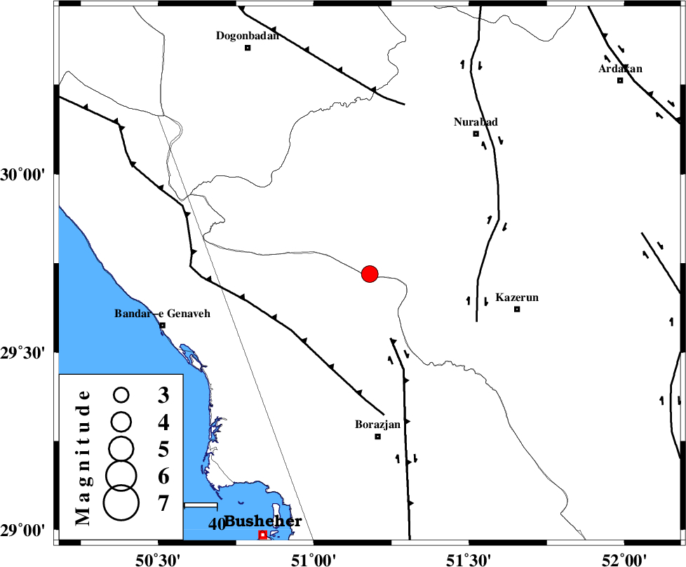
| Location | Lat:29.72 Lon: 51.18 |
| Region | Fars Province, 51 km North of Borazjan |
Nearest Cities |
|
| 23 km North West of Khesht, Fars Province | |
| 30 km North West of Kamaraj, Fars Province | |
| 33 km North East of Dehkohneh, Bushehr Province | |
| 34 km North West of Dalki, Bushehr Province | |
| 38 km North West of Deris, Fars Province | |
| Depth | 43 km |
| Agency | |
Faults within 150 km: |
|
| BORAZJAN_F (Length: 168 km) , Distance to epicenter: 21 km | |
| ZFF3 (Length: 125 km) , Distance to epicenter: 30 km | |
| KAZERUN_F (Length: 96 km) , Distance to epicenter: 34 km | |
| Number of Phases | 8 |
| RMS | 0.1 |
| Number of Stations | 6 |
| Error in Latitude | >1.7 km |
| Error in Longitude | 4.5 km |
| Error in Depth | 3.9 km |
Download waveform in seisan format
to download seisan software Click here
to access information about IIEES stations Click here
Amplitude | ||||||||
| UID | Agency | Station | Component | Amplitude | Period | Arrival Time | Proccessing Time | Signal Clip |
| 89575 | IIEES | AHRM | N | 1150.5 | 0.4 | 2013-06-07 10:49:05 | 2013-06-07 12:18:00 | n |
| 89576 | IIEES | GHIR | E | 224.2 | 0.44 | 2013-06-07 10:49:42 | 2013-06-07 12:18:00 | n |
| 89577 | IIEES | GHIR | N | 249.1 | 0.44 | 2013-06-07 10:49:55 | 2013-06-07 12:18:00 | n |
Phase | ||||||||||||
| Agency | Station | Component | Phase Type | Phase Quality | First Motion | Observed Arrival Time | Time Residual | Loc. Flag | Input Weight | Distance | Azimuth | |
| IIEES | AHRM | Z | Pg | E | 2013-06-07 10:48:46 | 0.05 | y | 95.6 | 173 | |||
| IIEES | GHIR | Z | Pn | E | 2013-06-07 10:49:04 | -0.17 | y | 237 | 132 | |||
| IIEES | GHIR | N | S | E | 2013-06-07 10:49:29 | 0.1 | y | 237 | 132 | |||
| IIEES | NASN | Z | Pn | E | 2013-06-07 10:49:21 | 0.01 | y | 375 | 24 | |||
| IIEES | YZKH | Z | Pn | E | 2013-06-07 10:49:29 | 0.08 | y | 440 | 47 | |||
| IIEES | GHVR | Z | Pn | E | 2013-06-07 10:49:40 | 0.03 | y | 528 | 1 | |||
| IIEES | KRBR | Z | Pn | E | 2013-06-07 10:49:42 | -0.14 | y | 540 | 86 | |||
| IIEES | KRBR | E | S | E | 2013-06-07 10:50:35 | 0.03 | y | 540 | 86 | |||