
Magnitude |
3.6 |
| Date & Time (UTC) | 2013-06-11 14:51:48.4 |
| Date & Time (Local) | 1392/3/21 19:21:48.4 |
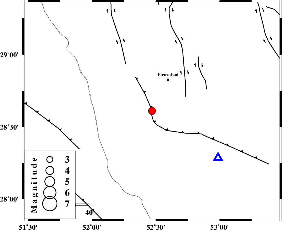
| Location | Lat:28.61 Lon: 52.47 |
| Region | Fars Province, 26 km South-West of Firuz Abad |
Nearest Cities |
|
| 21 km North East of Dahrom, Fars Province | |
| 23 km South of Ahmadabad, Fars Province | |
| 23 km South West of Jaydasht, Fars Province | |
| 27 km South West of Firuz Abad, Fars Province | |
| 32 km North West of Hengam, Fars Province | |
| Depth | 15 km |
| Agency | |
Faults within 150 km: |
|
| QIR_F (Length: 130 km) , Distance to epicenter: 1 km | |
| SABZ_PUSHAN_F_Z1 (Length: 69 km) , Distance to epicenter: 28 km | |
| KAREBASS_F (Length: 98 km) , Distance to epicenter: 41 km | |
| Number of Phases | 3 |
| RMS | 0 |
| Number of Stations | 3 |
| Error in Latitude | >2.6 km |
| Error in Longitude | 2.1 km |
| Error in Depth | 0 km |
Download waveform in seisan format
to download seisan software Click here
to access information about IIEES stations Click here
Amplitude | ||||||||
| UID | Agency | Station | Component | Amplitude | Period | Arrival Time | Proccessing Time | Signal Clip |
| 89614 | IIEES | GHIR | N | 2977.8 | 0.36 | 2013-06-11 14:52:19 | 2013-06-11 06:03:00 | n |
| 89615 | IIEES | AHRM | N | 2059.8 | 0.44 | 2013-06-11 14:52:31 | 2013-06-11 06:03:00 | n |
Phase | ||||||||||||
| Agency | Station | Component | Phase Type | Phase Quality | First Motion | Observed Arrival Time | Time Residual | Loc. Flag | Input Weight | Distance | Azimuth | |
| IIEES | GHIR | Z | Pg | E | 2013-06-11 14:51:59 | 0 | y | 62.1 | 126 | |||
| IIEES | AHRM | Z | Pg | E | 2013-06-11 14:52:08 | 0 | y | 118 | 284 | |||
| IIEES | NASN | Z | Pn | E | 2013-06-11 14:52:54 | 0 | y | 465 | 4 | |||