
Magnitude |
3.1 |
| Date & Time (UTC) | 2013-06-14 01:54:49.1 |
| Date & Time (Local) | 1392/3/24 06:24:49.1 |
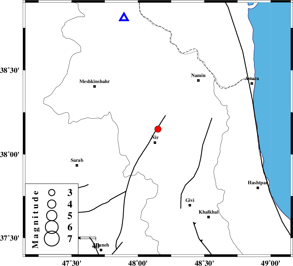
| Location | Lat:38.15 Lon: 48.15 |
| Region | Ardebil Province, 9 km Nir |
Nearest Cities |
|
| 4 km North of Rezaqoli qeshlaq, Ardebil Province | |
| 5 km of Sareyin, Ardebil Province | |
| 5 km of Varniab, Ardebil Province | |
| 7 km of Ardimusa, Ardebil Province | |
| 9 km North of Eslamabad, Ardebil Province | |
| Depth | 15 km |
| Agency | |
Faults within 150 km: |
|
| BOZQUSH (Length: 70 km) , Distance to epicenter: 10 km | |
| SANGAVAR_F (Length: 61 km) , Distance to epicenter: 31 km | |
| TALESH_F (Length: 258 km) , Distance to epicenter: 65 km | |
| Number of Phases | 4 |
| RMS | 0.3 |
| Number of Stations | 3 |
| Error in Latitude | >0.8 km |
| Error in Longitude | 4.5 km |
| Error in Depth | 0 km |
Download waveform in seisan format
to download seisan software Click here
to access information about IIEES stations Click here
Amplitude | ||||||||
| UID | Agency | Station | Component | Amplitude | Period | Arrival Time | Proccessing Time | Signal Clip |
| 89637 | IIEES | ZNJK | N | 213.7 | 0.26 | 2013-06-14 01:55:43 | 2013-06-14 03:21:00 | n |
| 89638 | IIEES | ZNJK | E | 221.5 | 0.48 | 2013-06-14 01:55:43 | 2013-06-14 03:21:00 | n |
Phase | ||||||||||||
| Agency | Station | Component | Phase Type | Phase Quality | First Motion | Observed Arrival Time | Time Residual | Loc. Flag | Input Weight | Distance | Azimuth | |
| IIEES | GRMI | Z | Pg | E | 2013-06-14 01:55:02 | -0.12 | y | 76.9 | 343 | |||
| IIEES | ZNJK | Z | Pg | E | 2013-06-14 01:55:17 | 0.44 | y | 171 | 164 | |||
| IIEES | ZNJK | E | Sg | E | 2013-06-14 01:55:37 | -0.32 | y | 171 | 164 | |||
| IIEES | CHTH | Z | Pn | E | 2013-06-14 01:55:42 | 0 | y | 363 | 132 | |||