
Magnitude |
3.1 |
| Date & Time (UTC) | 2013-06-18 21:00:56.3 |
| Date & Time (Local) | 1392/3/29 01:30:56.3 |
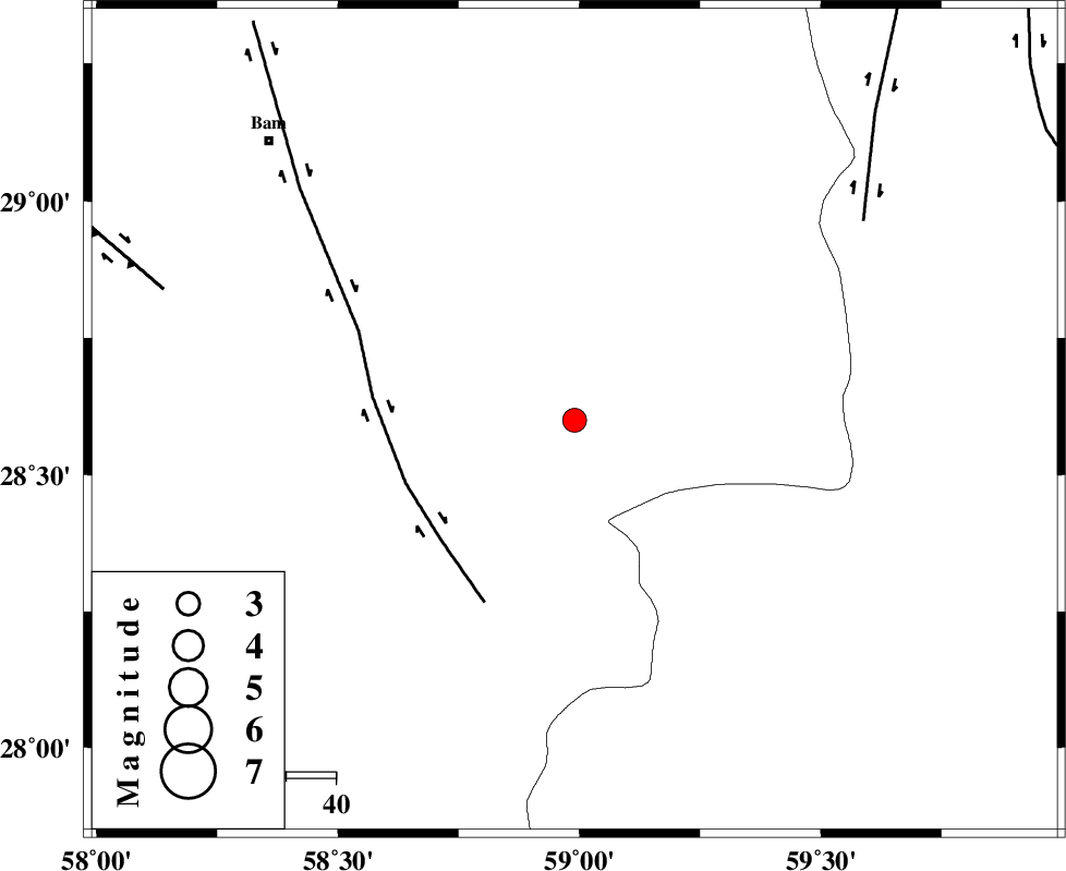
| Location | Lat:28.6 Lon: 58.99 |
| Region | Kerman Province, 83 km South-East of Bam |
Nearest Cities |
|
| 13 km South of Hoseynabad, Kerman Province | |
| 17 km South East of Mohammadabad-e gonbaki, Kerman Province | |
| 31 km South of Void, Kerman Province | |
| 41 km South East of Fahroj, Kerman Province | |
| 52 km South East of Qasemabad, Kerman Province | |
| Depth | 14 km |
| Agency | |
Faults within 150 km: |
|
| BAM_F (Length: 118 km) , Distance to epicenter: 36 km | |
| KANURAK_F (Length: 135 km) , Distance to epicenter: 71 km | |
| GOWK_F (Length: 152 km) , Distance to epicenter: 87 km | |
| Number of Phases | 5 |
| RMS | 0.2 |
| Number of Stations | 3 |
| Error in Latitude | >4.9 km |
| Error in Longitude | 2.8 km |
| Error in Depth | 7.2 km |
Download waveform in seisan format
to download seisan software Click here
to access information about IIEES stations Click here
Amplitude | ||||||||
| UID | Agency | Station | Component | Amplitude | Period | Arrival Time | Proccessing Time | Signal Clip |
| 89687 | IIEES | KRBR | E | 88.7 | 0.2 | 2013-06-18 21:02:14 | 2013-06-18 10:37:00 | n |
| 89688 | IIEES | KRBR | N | 97.5 | 0.2 | 2013-06-18 21:02:14 | 2013-06-18 10:37:00 | n |
| 89689 | IIEES | BSRN | N | 38.6 | 0.4 | 2013-06-18 21:02:47 | 2013-06-18 10:37:00 | n |
Phase | ||||||||||||
| Agency | Station | Component | Phase Type | Phase Quality | First Motion | Observed Arrival Time | Time Residual | Loc. Flag | Input Weight | Distance | Azimuth | |
| IIEES | ZHSF | Z | Pg | E | 2013-06-18 21:01:30 | -0.03 | y | 207 | 57 | |||
| IIEES | KRBR | Z | Pn | E | 2013-06-18 21:01:36 | -0.3 | y | 265 | 306 | |||
| IIEES | KRBR | N | Sg | E | 2013-06-18 21:02:11 | 0.12 | y | 265 | 306 | |||
| IIEES | BSRN | Z | Pn | E | 2013-06-18 21:01:50 | 0.41 | y | 373 | 2 | |||
| IIEES | BSRN | N | Sg | E | 2013-06-18 21:02:40 | -0.15 | y | 373 | 2 | |||