
Magnitude |
2.5 |
| Date & Time (UTC) | 2013-06-21 19:52:48.4 |
| Date & Time (Local) | 1392/4/1 00:22:48.4 |
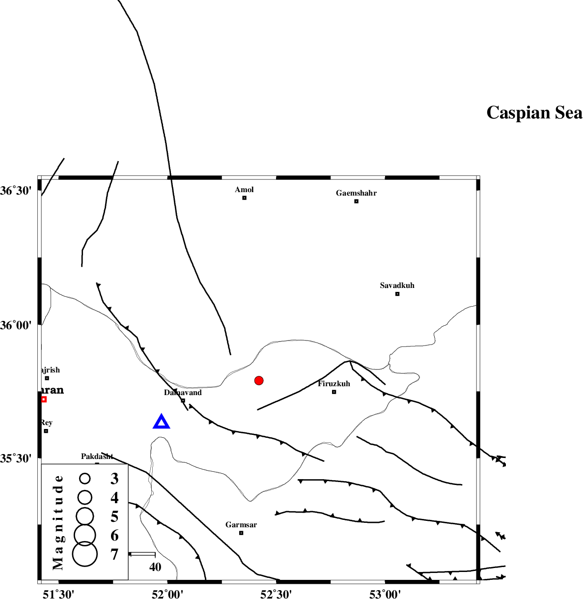
| Location | Lat:35.79 Lon: 52.42 |
| Region | Tehran Province, 32 km West of Firuzkuh |
Nearest Cities |
|
| 10 km West of Arjomand, Tehran Province | |
| 19 km North East of Sarbandan, Tehran Province | |
| 24 km South East of Gaznak, Mazandaran Province | |
| 24 km West of Shahrabad, Tehran Province | |
| 24 km South East of Baijan, Mazandaran Province | |
| Depth | 17 km |
| Agency | |
Faults within 150 km: |
|
| MOSHA_F (Length: 234 km) , Distance to epicenter: 11 km | |
| N_ALBORZ_F (Length: 360 km) , Distance to epicenter: 46 km | |
| ATARI_F (Length: 185 km) , Distance to epicenter: 50 km | |
| Number of Phases | 6 |
| RMS | 0.1 |
| Number of Stations | 5 |
| Error in Latitude | >2.2 km |
| Error in Longitude | 5.3 km |
| Error in Depth | 4.5 km |
Download waveform in seisan format
to download seisan software Click here
to access information about IIEES stations Click here
Amplitude | ||||||||
| UID | Agency | Station | Component | Amplitude | Period | Arrival Time | Proccessing Time | Signal Clip |
| 89703 | IIEES | THKV | N | 79.3 | 0.44 | 2013-06-21 19:53:21 | 2013-06-21 09:12:00 | n |
| 89704 | IIEES | GHVR | E | 50.7 | 0.28 | 2013-06-21 19:53:50 | 2013-06-21 09:12:00 | n |
Phase | ||||||||||||
| Agency | Station | Component | Phase Type | Phase Quality | First Motion | Observed Arrival Time | Time Residual | Loc. Flag | Input Weight | Distance | Azimuth | |
| IIEES | DAMV | Z | Pg | E | 2013-06-21 19:52:56 | -0.07 | y | 43.9 | 247 | |||
| IIEES | DAMV | E | Sg | E | 2013-06-21 19:53:02 | -0.1 | y | 43.9 | 247 | |||
| IIEES | CHTH | Z | Pg | E | 2013-06-21 19:53:08 | 0.16 | y | 117 | 277 | |||
| IIEES | GHVR | Z | Pg | E | 2013-06-21 19:53:18 | -0.07 | y | 180 | 217 | |||
| IIEES | GHVR | E | Sg | E | 2013-06-21 19:53:39 | 0.14 | y | 180 | 217 | |||
| IIEES | ASAO | Z | Pn | E | 2013-06-21 19:53:27 | -0.07 | y | 257 | 238 | |||