
Magnitude |
1.6 |
| Date & Time (UTC) | 2013-06-22 14:19:19.5 |
| Date & Time (Local) | 1392/4/1 18:49:19.5 |
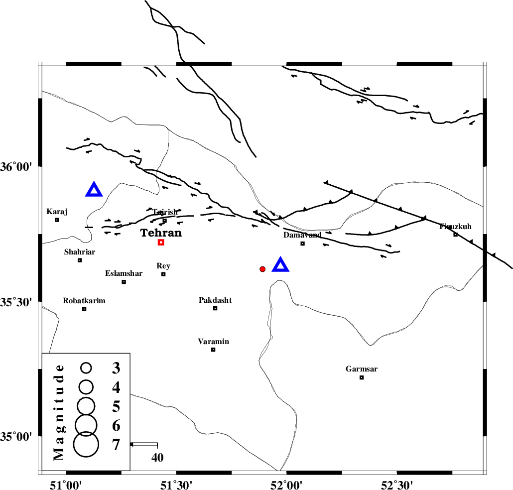
| Location | Lat:35.62 Lon: 51.89 |
| Region | Tehran Province, 20 km West of Damavand |
Nearest Cities |
|
| 12 km West of Ab sard, Tehran Province | |
| 13 km South of Rudehen, Tehran Province | |
| 14 km South of Bumehen, Tehran Province | |
| 19 km South West of Abali, Tehran Province | |
| 20 km West of Damavand, Tehran Province | |
| Depth | 14 km |
| Agency | |
Faults within 150 km: |
|
| EYVANEKEY_F (Length: 74 km) , Distance to epicenter: 19 km | |
| MOSHA_F (Length: 234 km) , Distance to epicenter: 21 km | |
| N_TEHRAN_F4 (Length: 115 km) , Distance to epicenter: 25 km | |
| Number of Phases | 5 |
| RMS | 0.1 |
| Number of Stations | 3 |
| Error in Latitude | >1.9 km |
| Error in Longitude | 2.4 km |
| Error in Depth | 3 km |
Download waveform in seisan format
to download seisan software Click here
to access information about IIEES stations Click here
Amplitude | ||||||||
| UID | Agency | Station | Component | Amplitude | Period | Arrival Time | Proccessing Time | Signal Clip |
| 89716 | IIEES | CHTH | E | 19.9 | 0.48 | 2013-06-22 14:19:43 | 2013-06-23 02:14:00 | n |
| 89717 | IIEES | CHTH | N | 34.8 | 0.44 | 2013-06-22 14:19:43 | 2013-06-23 02:14:00 | n |
| 89718 | IIEES | ASAO | E | 5.4 | 0.44 | 2013-06-22 14:20:23 | 2013-06-23 02:14:00 | n |
Phase | ||||||||||||
| Agency | Station | Component | Phase Type | Phase Quality | First Motion | Observed Arrival Time | Time Residual | Loc. Flag | Input Weight | Distance | Azimuth | |
| IIEES | DAMV | Z | Pg | E | 2013-06-22 14:19:22 | -0.05 | y | 7.55 | 84 | |||
| IIEES | CHTH | Z | Pg | E | 2013-06-22 14:19:33 | 0.18 | y | 75.8 | 295 | |||
| IIEES | CHTH | E | Sg | E | 2013-06-22 14:19:42 | -0.12 | y | 75.8 | 295 | |||
| IIEES | ASAO | Z | Pn | E | 2013-06-22 14:19:53 | 0.04 | y | 208 | 235 | |||
| IIEES | ASAO | E | Sg | E | 2013-06-22 14:20:18 | -0.05 | y | 208 | 235 | |||