
Magnitude |
3.5 |
| Date & Time (UTC) | 2013-06-23 23:58:51.8 |
| Date & Time (Local) | 1392/4/3 04:28:51.8 |
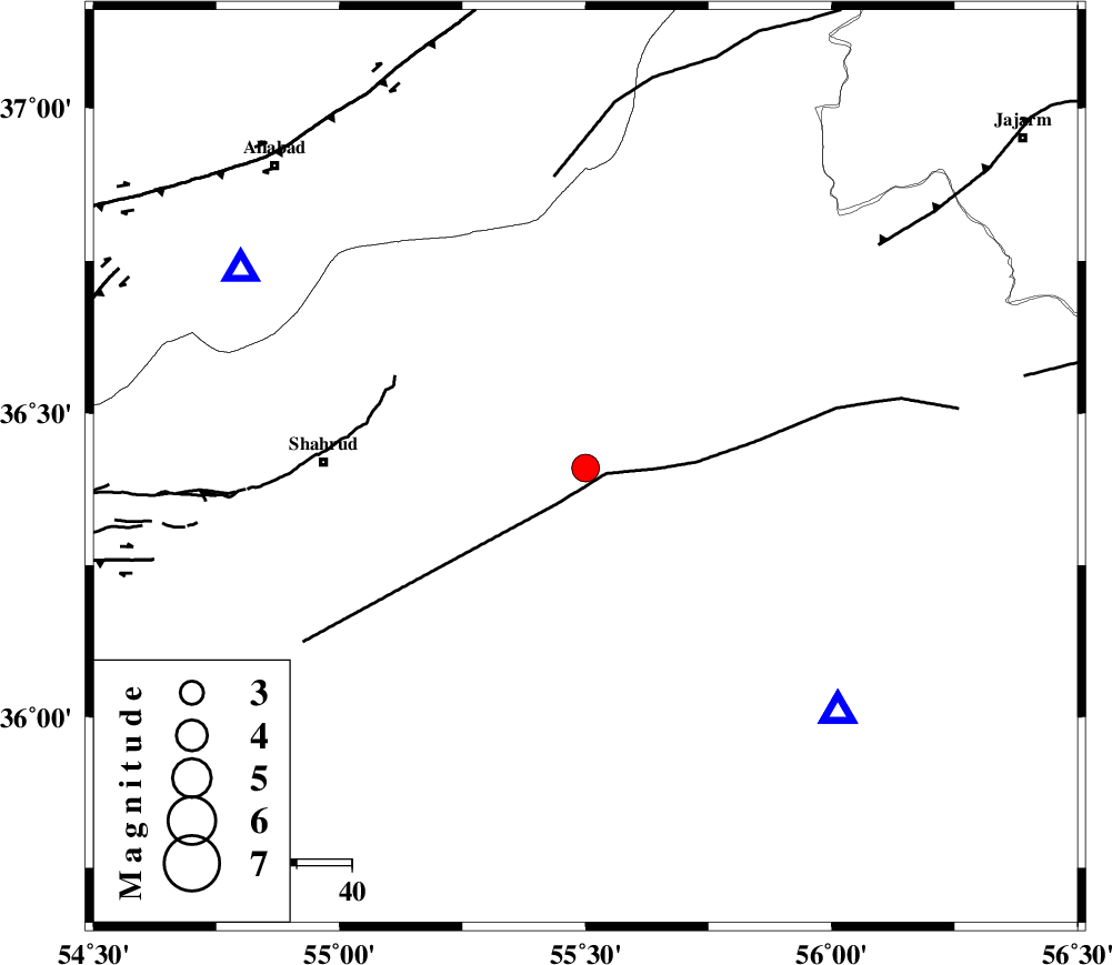
| Location | Lat:36.41 Lon: 55.5 |
| Region | Semnan Province, 47 km East of Shahrud |
Nearest Cities |
|
| 14 km North West of Miamay, Semnan Province | |
| 33 km South East of Kalateh khanj, Semnan Province | |
| 43 km South East of Qaleh-ye nokharqan, Semnan Province | |
| 45 km North East of Ruyan, Semnan Province | |
| 45 km East of Bastam, Semnan Province | |
| Depth | 14 km |
| Agency | |
Faults within 150 km: |
|
| MEYAMEY_F (Length: 141 km) , Distance to epicenter: 4 km | |
| SHAVAR_F (Length: 87 km) , Distance to epicenter: 48 km | |
| ROBATE_QARABIL_F (Length: 168 km) , Distance to epicenter: 53 km | |
| Number of Phases | 6 |
| RMS | 0.1 |
| Number of Stations | 5 |
| Error in Latitude | >3.9 km |
| Error in Longitude | 3.7 km |
| Error in Depth | 13.5 km |
Download waveform in seisan format
to download seisan software Click here
to access information about IIEES stations Click here
Amplitude | ||||||||
| UID | Agency | Station | Component | Amplitude | Period | Arrival Time | Proccessing Time | Signal Clip |
| 89730 | IIEES | TABS | N | 144 | 0.76 | 2013-06-24 00:00:40 | 2013-06-24 01:32:00 | n |
Phase | ||||||||||||
| Agency | Station | Component | Phase Type | Phase Quality | First Motion | Observed Arrival Time | Time Residual | Loc. Flag | Input Weight | Distance | Azimuth | |
| IIEES | MRVT | Z | Pg | E | 2013-06-23 23:59:16 | -0.05 | y | 148 | 21 | |||
| IIEES | MRVT | E | Sg | E | 2013-06-23 23:59:34 | 0.02 | y | 148 | 21 | |||
| IIEES | DAMV | Z | P | E | 2013-06-23 23:59:40 | 0.06 | y | 329 | 256 | |||
| IIEES | TABS | Z | Pn | E | 2013-06-23 23:59:41 | 0.12 | y | 340 | 154 | |||
| IIEES | GHVR | Z | P | E | 2013-06-23 23:59:54 | 0.02 | y | 441 | 242 | |||
| IIEES | YZKH | Z | P | E | 2013-06-23 23:59:55 | -0.2 | y | 454 | 191 | |||