
Magnitude |
1.7 |
| Date & Time (UTC) | 2013-06-24 11:06:31.9 |
| Date & Time (Local) | 1392/4/3 15:36:31.9 |
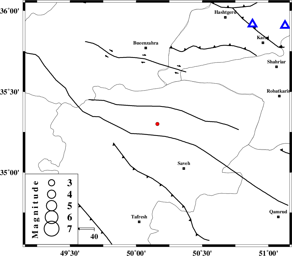
| Location | Lat:35.3 Lon: 50.16 |
| Region | Markazi Province, 36 km North-West of Saveh |
Nearest Cities |
|
| 19 km East of Razegian, Markazi Province | |
| 19 km West of Khoshkrud, Markazi Province | |
| 29 km North East of Qeytaniyeh, Markazi Province | |
| 33 km South East of Duzaj, Markazi Province | |
| 33 km West of Hakimabad, Markazi Province | |
| Depth | 18 km |
| Agency | |
Faults within 150 km: |
|
| KUSHK_E_NOSRAT_F (Length: 230 km) , Distance to epicenter: 10 km | |
| S_PARANDAK_F (Length: 116 km) , Distance to epicenter: 12 km | |
| INDES_F (Length: 98 km) , Distance to epicenter: 33 km | |
| Number of Phases | 5 |
| RMS | 0.1 |
| Number of Stations | 4 |
| Error in Latitude | >1.3 km |
| Error in Longitude | 2.8 km |
| Error in Depth | 3.9 km |
Download waveform in seisan format
to download seisan software Click here
to access information about IIEES stations Click here
Amplitude | ||||||||
| UID | Agency | Station | Component | Amplitude | Period | Arrival Time | Proccessing Time | Signal Clip |
| 89747 | IIEES | GHVR | N | 16.9 | 0.44 | 2013-06-24 11:07:13 | 2013-06-25 01:02:00 | n |
| 89748 | IIEES | GHVR | E | 14.4 | 0.64 | 2013-06-24 11:07:30 | 2013-06-25 01:02:00 | n |
Phase | ||||||||||||
| Agency | Station | Component | Phase Type | Phase Quality | First Motion | Observed Arrival Time | Time Residual | Loc. Flag | Input Weight | Distance | Azimuth | |
| IIEES | ASAO | Z | Pg | E | 2013-06-24 11:06:46 | -0.1 | y | 84.4 | 189 | |||
| IIEES | GHVR | Z | Pg | E | 2013-06-24 11:06:54 | 0.05 | y | 134 | 132 | |||
| IIEES | KHMZ | Z | Pn | E | 2013-06-24 11:07:00 | -0.09 | y | 174 | 186 | |||
| IIEES | KHMZ | N | Sg | E | 2013-06-24 11:07:21 | 0.11 | y | 174 | 186 | |||
| IIEES | ZNJK | N | Sg | E | 2013-06-24 11:07:29 | 0.03 | y | 202 | 319 | |||