
Magnitude |
2.3 |
| Date & Time (UTC) | 2013-06-27 03:27:14.9 |
| Date & Time (Local) | 1392/4/6 07:57:14.9 |
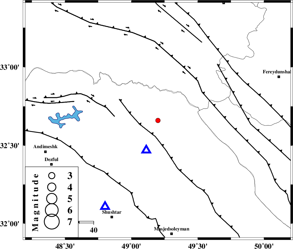
| Location | Lat:32.66 Lon: 49.2 |
| Region | Khoozestan Province, 31 km North of Lali |
Nearest Cities |
|
| 31 km North of Lali, Khoozestan Province | |
| 38 km South West of Parchal, Lorestan Province | |
| 38 km North East of Sardasht, Khoozestan Province | |
| 40 km South East of Shuy, Khoozestan Province | |
| 44 km North of Jaefarabad, Khoozestan Province | |
| Depth | 16 km |
| Agency | |
Faults within 150 km: |
|
| MFF2 (Length: 205 km) , Distance to epicenter: 12 km | |
| BALARUD_F_Z2 (Length: 58 km) , Distance to epicenter: 31 km | |
| HZF4 (Length: 492 km) , Distance to epicenter: 37 km | |
| Number of Phases | 4 |
| RMS | 0 |
| Number of Stations | 4 |
| Error in Latitude | >5.2 km |
| Error in Longitude | 10 km |
| Error in Depth | 3.8 km |
Download waveform in seisan format
to download seisan software Click here
to access information about IIEES stations Click here
Amplitude | ||||||||
| UID | Agency | Station | Component | Amplitude | Period | Arrival Time | Proccessing Time | Signal Clip |
| 89764 | IIEES | SHGR | N | 192.2 | 0.56 | 2013-06-27 03:27:46 | 2013-06-27 06:15:00 | n |
| 89765 | IIEES | KHMZ | E | 36.9 | 0.48 | 2013-06-27 03:28:05 | 2013-06-27 06:15:00 | n |
Phase | ||||||||||||
| Agency | Station | Component | Phase Type | Phase Quality | First Motion | Observed Arrival Time | Time Residual | Loc. Flag | Input Weight | Distance | Azimuth | |
| IIEES | SHGR | Z | Pg | E | 2013-06-27 03:27:27 | 0 | y | 71.1 | 212 | |||
| IIEES | KHMZ | Z | Pg | E | 2013-06-27 03:27:38 | 0 | y | 140 | 31 | |||
| IIEES | ASAO | Z | Pn | E | 2013-06-27 03:27:50 | 0 | y | 224 | 20 | |||
| IIEES | GHVR | Z | Pn | E | 2013-06-27 03:27:56 | 0 | y | 278 | 43 | |||