
Magnitude |
2 |
| Date & Time (UTC) | 2013-06-29 06:56:12.5 |
| Date & Time (Local) | 1392/4/8 11:26:12.5 |
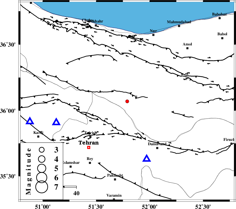
| Location | Lat:36.07 Lon: 51.79 |
| Region | Mazandaran Province, 43 km North-East of Tajrish |
Nearest Cities |
|
| 14 km South of Baladeh, Mazandaran Province | |
| 25 km South West of Pil, Mazandaran Province | |
| 25 km North East of Afjeh, Tehran Province | |
| 27 km South East of Void, Mazandaran Province | |
| 28 km North East of Fasham, Tehran Province | |
| Depth | 14 km |
| Agency | |
Faults within 150 km: |
|
| KANDOVAN_F (Length: 90 km) , Distance to epicenter: 10 km | |
| MOSHA_F (Length: 234 km) , Distance to epicenter: 24 km | |
| N_TEHRAN_F4 (Length: 115 km) , Distance to epicenter: 27 km | |
| Number of Phases | 6 |
| RMS | 0.3 |
| Number of Stations | 4 |
| Error in Latitude | >5.4 km |
| Error in Longitude | 6.3 km |
| Error in Depth | 9.7 km |
Download waveform in seisan format
to download seisan software Click here
to access information about IIEES stations Click here
Amplitude | ||||||||
| UID | Agency | Station | Component | Amplitude | Period | Arrival Time | Proccessing Time | Signal Clip |
| 89782 | IIEES | DAMV | E | 124.4 | 0.15 | 2013-06-29 06:56:29 | 2013-06-29 10:39:00 | n |
Phase | ||||||||||||
| Agency | Station | Component | Phase Type | Phase Quality | First Motion | Observed Arrival Time | Time Residual | Loc. Flag | Input Weight | Distance | Azimuth | |
| IIEES | DAMV | Z | Pg | E | 2013-06-29 06:56:22 | 0.15 | y | 51.9 | 161 | |||
| IIEES | DAMV | E | Sg | E | 2013-06-29 06:56:28 | -0.38 | y | 51.9 | 161 | |||
| IIEES | CHTH | Z | Pg | E | 2013-06-29 06:56:23 | -0.35 | y | 62.5 | 253 | |||
| IIEES | GHVR | Z | Pg | E | 2013-06-29 06:56:43 | 0.5 | y | 184 | 196 | |||
| IIEES | GHVR | N | Sg | E | 2013-06-29 06:57:04 | 0.05 | y | 184 | 196 | |||
| IIEES | ASAO | Z | Pn | E | 2013-06-29 06:56:49 | 0.03 | y | 233 | 224 | |||