
Magnitude |
3.7 |
| Date & Time (UTC) | 2013-06-30 04:24:04.3 |
| Date & Time (Local) | 1392/4/9 08:54:04.3 |
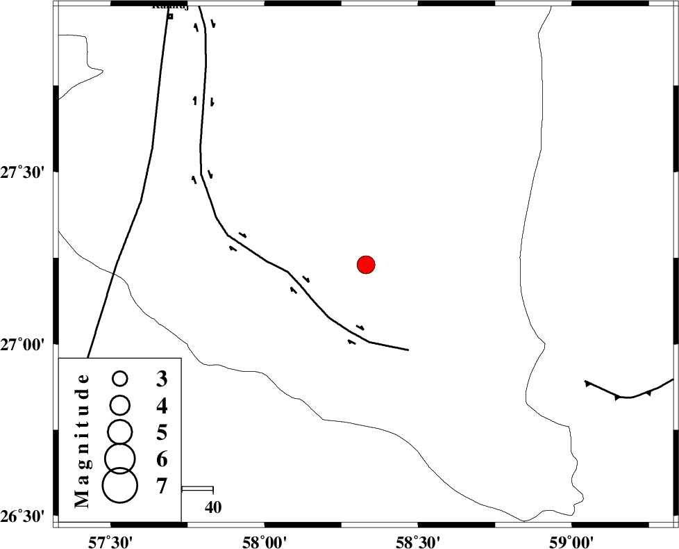
| Location | Lat:27.23 Lon: 58.33 |
| Region | Kerman Province, 85 km South-East of Manujan |
Nearest Cities |
|
| 43 km North East of Keshmiran, Kerman Province | |
| 55 km South East of Qalehy-eganj, Kerman Province | |
| 64 km North West of Ramashk, Kerman Province | |
| 80 km South East of Bargah, Kerman Province | |
| 82 km North East of Angahran, Hormozgan Province | |
| Depth | 15 km |
| Agency | |
Faults within 150 km: |
|
| JIROFT_F (Length: 144 km) , Distance to epicenter: 21 km | |
| SABZEVARAN_F (Length: 190 km) , Distance to epicenter: 75 km | |
| S_JAZMURIAN_F (Length: 91 km) , Distance to epicenter: 80 km | |
| Number of Phases | 6 |
| RMS | 0.2 |
| Number of Stations | 7 |
| Error in Latitude | >8.8 km |
| Error in Longitude | 2.1 km |
| Error in Depth | 0 km |
Download waveform in seisan format
to download seisan software Click here
to access information about IIEES stations Click here
Amplitude | ||||||||
| UID | Agency | Station | Component | Amplitude | Period | Arrival Time | Proccessing Time | Signal Clip |
| 89785 | IIEES | BNDS | N | 664.6 | 0.48 | 2013-06-30 04:24:33 | 2013-06-30 06:04:00 | n |
Phase | ||||||||||||
| Agency | Station | Component | Phase Type | Phase Quality | First Motion | Observed Arrival Time | Time Residual | Loc. Flag | Input Weight | Distance | Azimuth | |
| IIEES | ZHSF | Z | Pn | E | 2013-06-30 04:24:56 | -0.08 | y | 356 | 42 | |||
| IIEES | BSRN | Z | P | I | 2013-06-30 04:25:18 | 0.1 | y | 530 | 8 | |||
| IIEES | GHIR | Z | Pn | E | 2013-06-30 04:25:19 | 0.1 | y | 539 | 284 | |||
| IIEES | YZKH | Z | P | E | 2013-06-30 04:25:35 | -0.48 | y | 676 | 329 | |||
| IIEES | TABS | Z | Pn | E | 2013-06-30 04:25:41 | 0.37 | y | 721 | 351 | |||
| IIEES | SHRT | Z | Pn | E | 2013-06-30 04:25:43 | 0.03 | y | 736 | 14 | |||