
Magnitude |
3.6 |
| Date & Time (UTC) | 2013-07-02 16:04:42.4 |
| Date & Time (Local) | 1392/4/11 20:34:42.4 |
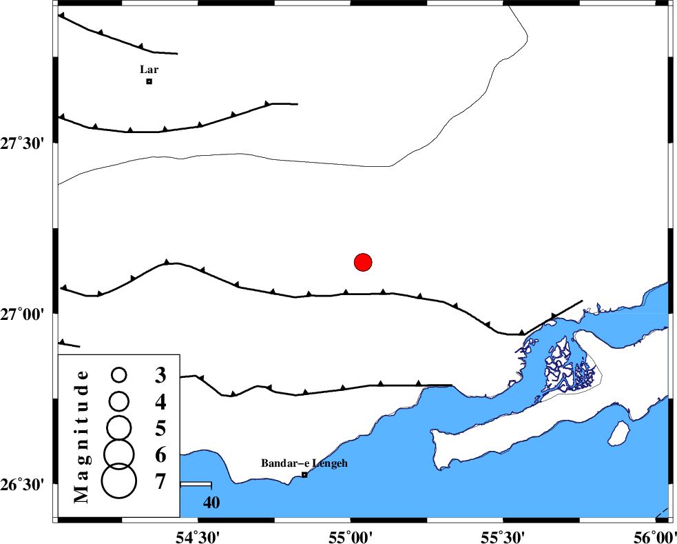
| Location | Lat:27.15 Lon: 55.04 |
| Region | Hormozgan Province, 67 km East of Bastak |
Nearest Cities |
|
| 59 km North West of Bandar-e khamir, Hormozgan Province | |
| 67 km East of Bastak, Hormozgan Province | |
| 72 km North East of Bandar-e lengeh, Hormozgan Province | |
| 76 km North East of Jenah, Hormozgan Province | |
| 88 km South West of Darz, Fars Province | |
| Depth | 14 km |
| Agency | |
Faults within 150 km: |
|
| MFF1 (Length: 180 km) , Distance to epicenter: 10 km | |
| ZFF1 (Length: 165 km) , Distance to epicenter: 40 km | |
| LAR_F (Length: 99 km) , Distance to epicenter: 56 km | |
| Number of Phases | 5 |
| RMS | 0.1 |
| Number of Stations | 4 |
| Error in Latitude | >24.8 km |
| Error in Longitude | 7.6 km |
| Error in Depth | 28.8 km |
Download waveform in seisan format
to download seisan software Click here
to access information about IIEES stations Click here
Amplitude | ||||||||
| UID | Agency | Station | Component | Amplitude | Period | Arrival Time | Proccessing Time | Signal Clip |
| 89811 | IIEES | GHIR | E | 396.6 | 0.48 | 2013-07-02 16:06:05 | 2013-07-02 05:28:00 | n |
Phase | ||||||||||||
| Agency | Station | Component | Phase Type | Phase Quality | First Motion | Observed Arrival Time | Time Residual | Loc. Flag | Input Weight | Distance | Azimuth | |
| IIEES | GHIR | Z | Pn | E | 2013-07-02 16:05:19 | 0 | y | 238 | 302 | |||
| IIEES | GHIR | E | Sg | E | 2013-07-02 16:05:49 | 0 | y | 238 | 302 | |||
| IIEES | KRBR | Z | Pn | E | 2013-07-02 16:05:34 | 0.1 | y | 356 | 28 | |||
| IIEES | BSRN | Z | Pn | E | 2013-07-02 16:06:12 | -0.13 | y | 665 | 36 | |||
| IIEES | TABS | Z | Pn | E | 2013-07-02 16:06:22 | -0.05 | y | 748 | 15 | |||