
Magnitude |
2.4 |
| Date & Time (UTC) | 2013-07-04 16:31:25.8 |
| Date & Time (Local) | 1392/4/13 21:01:25.8 |
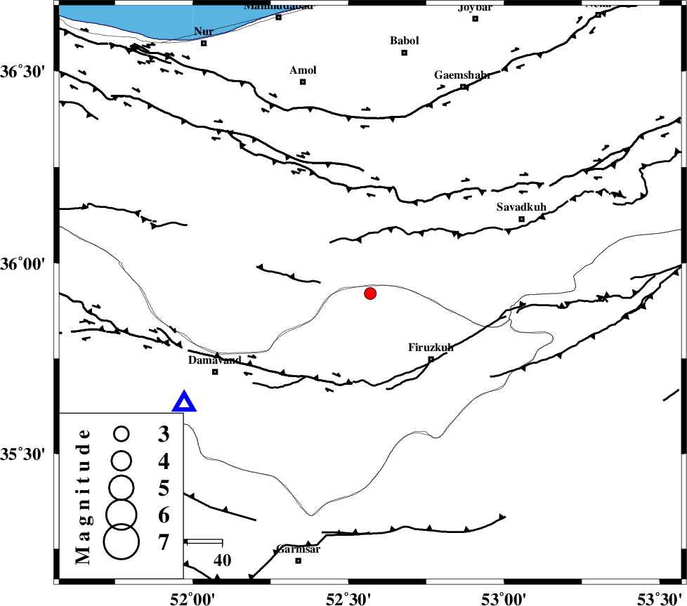
| Location | Lat:35.92 Lon: 52.57 |
| Region | Tehran Province, 26 km North-West of Firuzkuh |
Nearest Cities |
|
| 13 km North of Arjomand, Tehran Province | |
| 17 km North West of Shahrabad, Tehran Province | |
| 26 km East of Baijan, Mazandaran Province | |
| 26 km North West of Firuzkuh, Tehran Province | |
| 28 km South West of Alasht, Mazandaran Province | |
| Depth | 14 km |
| Agency | |
Faults within 150 km: |
|
| MOSHA_F (Length: 234 km) , Distance to epicenter: 27 km | |
| N_ALBORZ_F (Length: 360 km) , Distance to epicenter: 30 km | |
| ATARI_F (Length: 185 km) , Distance to epicenter: 43 km | |
| Number of Phases | 5 |
| RMS | 0.2 |
| Number of Stations | 3 |
| Error in Latitude | >3.4 km |
| Error in Longitude | 8.1 km |
| Error in Depth | 8.8 km |
Download waveform in seisan format
to download seisan software Click here
to access information about IIEES stations Click here
Amplitude | ||||||||
| UID | Agency | Station | Component | Amplitude | Period | Arrival Time | Proccessing Time | Signal Clip |
| 89819 | IIEES | GHVR | N | 36.2 | 0.36 | 2013-07-04 16:32:29 | 2013-07-05 02:12:00 | n |
| 89820 | IIEES | GHVR | E | 63.8 | 0.36 | 2013-07-04 16:32:29 | 2013-07-05 02:12:00 | n |
| 89821 | IIEES | ASAO | E | 14 | 0.52 | 2013-07-04 16:32:42 | 2013-07-05 02:12:00 | n |
Phase | ||||||||||||
| Agency | Station | Component | Phase Type | Phase Quality | First Motion | Observed Arrival Time | Time Residual | Loc. Flag | Input Weight | Distance | Azimuth | |
| IIEES | CHTH | Z | Pg | E | 2013-07-04 16:31:47 | -0.31 | y | 130 | 270 | |||
| IIEES | CHTH | E | Sg | E | 2013-07-04 16:32:03 | 0.14 | y | 130 | 270 | |||
| IIEES | GHVR | Z | Pn | E | 2013-07-04 16:31:58 | 0.06 | y | 200 | 217 | |||
| IIEES | GHVR | E | Sg | E | 2013-07-04 16:32:22 | -0.09 | y | 200 | 217 | |||
| IIEES | ASAO | Z | Pn | E | 2013-07-04 16:32:08 | 0.21 | y | 277 | 237 | |||