
Magnitude |
3.1 |
| Date & Time (UTC) | 2013-07-08 07:27:26.9 |
| Date & Time (Local) | 1392/4/17 11:57:26.9 |
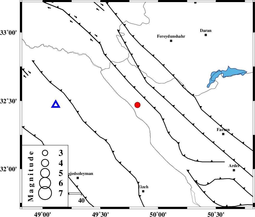
| Location | Lat:32.47 Lon: 49.82 |
| Region | Chaharmahal Bakhtiari Province, 28 km West of Chelgard |
Nearest Cities |
|
| 25 km South of Durak, Chaharmahal Bakhtiari Province | |
| 28 km North West of Chelgard, Chaharmahal Bakhtiari Province | |
| 31 km North East of Paabshalal, Khoozestan Province | |
| 42 km South of Masir, Esfahan Province | |
| 45 km West of Kukanak, Esfahan Province | |
| Depth | 14 km |
| Agency | |
Faults within 150 km: |
|
| ARDAL_F (Length: 170 km) , Distance to epicenter: 20 km | |
| ZARDKUH_F (Length: 139 km) , Distance to epicenter: 20 km | |
| MAIN_ZAGROS_R_F (Length: 1106 km) , Distance to epicenter: 38 km | |
| Number of Phases | 7 |
| RMS | 0.2 |
| Number of Stations | 5 |
| Error in Latitude | >2.5 km |
| Error in Longitude | 2.5 km |
| Error in Depth | 5.1 km |
Download waveform in seisan format
to download seisan software Click here
to access information about IIEES stations Click here
Amplitude | ||||||||
| UID | Agency | Station | Component | Amplitude | Period | Arrival Time | Proccessing Time | Signal Clip |
| 89841 | IIEES | SHGR | N | 614.6 | 0.23 | 2013-07-08 07:28:00 | 2013-07-08 10:23:00 | n |
| 89842 | IIEES | SHGR | E | 477.9 | 0.32 | 2013-07-08 07:28:07 | 2013-07-08 10:23:00 | n |
Phase | ||||||||||||
| Agency | Station | Component | Phase Type | Phase Quality | First Motion | Observed Arrival Time | Time Residual | Loc. Flag | Input Weight | Distance | Azimuth | |
| IIEES | SHGR | Z | Pg | E | 2013-07-08 07:27:44 | -0.06 | y | 104 | 247 | |||
| IIEES | KHMZ | Z | Pg | E | 2013-07-08 07:27:50 | -0.03 | y | 141 | 5 | |||
| IIEES | ASAO | Z | Pn | E | 2013-07-08 07:28:03 | 0.15 | y | 231 | 5 | |||
| IIEES | ASAO | E | Sg | E | 2013-07-08 07:28:32 | -0.22 | y | 231 | 5 | |||
| IIEES | GHVR | Z | Pn | E | 2013-07-08 07:28:07 | 0.45 | y | 259 | 30 | |||
| IIEES | NASN | Z | Pn | E | 2013-07-08 07:28:09 | -0.31 | y | 283 | 82 | |||
| IIEES | NASN | N | Sg | E | 2013-07-08 07:28:46 | 0.01 | y | 283 | 82 | |||