
Magnitude |
2.3 |
| Date & Time (UTC) | 2013-07-09 20:58:37.0 |
| Date & Time (Local) | 1392/4/19 01:28:37.0 |
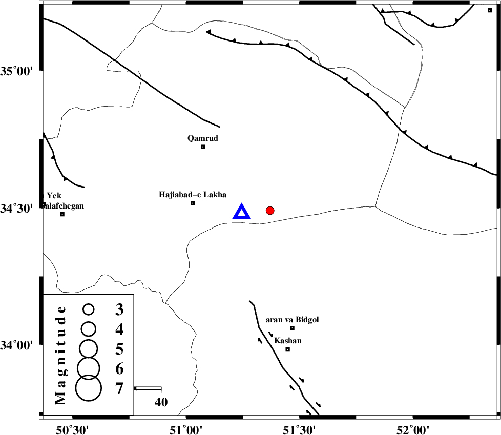
| Location | Lat:34.49 Lon: 51.37 |
| Region | Qom Province, 48 km North of Aran va bidgol |
Nearest Cities |
|
| 31 km East of Hajiabad-e lakha, Qom Province | |
| 37 km North East of Mashgan, Esfahan Province | |
| 37 km South East of Qamrud, Qom Province | |
| 40 km North of Nasrabad, Esfahan Province | |
| 43 km North East of Yahyaabad, Esfahan Province | |
| Depth | 6 km |
| Agency | |
Faults within 150 km: |
|
| KASHAN_F (Length: 44 km) , Distance to epicenter: 38 km | |
| KUSHK_E_NOSRAT_F (Length: 230 km) , Distance to epicenter: 39 km | |
| SIAHKUH_F (Length: 154 km) , Distance to epicenter: 61 km | |
| Number of Phases | 5 |
| RMS | 0.1 |
| Number of Stations | 4 |
| Error in Latitude | >5.3 km |
| Error in Longitude | 4.1 km |
| Error in Depth | 4.3 km |
Download waveform in seisan format
to download seisan software Click here
to access information about IIEES stations Click here
Amplitude | ||||||||
| UID | Agency | Station | Component | Amplitude | Period | Arrival Time | Proccessing Time | Signal Clip |
| 89865 | IIEES | GHVR | N | 10233.1 | 0.48 | 2013-07-09 20:58:41 | 2013-07-10 03:50:00 | n |
| 89866 | IIEES | KHMZ | N | 22.5 | 0.52 | 2013-07-09 20:59:25 | 2013-07-10 03:50:00 | n |
| 89867 | IIEES | KHMZ | E | 26.5 | 0.4 | 2013-07-09 20:59:28 | 2013-07-10 03:50:00 | n |
| 89868 | IIEES | THKV | N | 24.8 | 0.32 | 2013-07-09 20:59:29 | 2013-07-10 03:50:00 | n |
Phase | ||||||||||||
| Agency | Station | Component | Phase Type | Phase Quality | First Motion | Observed Arrival Time | Time Residual | Loc. Flag | Input Weight | Distance | Azimuth | |
| IIEES | GHVR | Z | Pg | E | 2013-07-09 20:58:39 | -0.07 | y | 11.7 | 265 | |||
| IIEES | GHVR | E | Sg | E | 2013-07-09 20:58:41 | -0.14 | y | 11.7 | 265 | |||
| IIEES | ASAO | Z | Pg | E | 2013-07-09 20:58:58 | 0.01 | y | 124 | 273 | |||
| IIEES | ASAO | E | Sg | E | 2013-07-09 20:59:14 | 0.12 | y | 124 | 273 | |||
| IIEES | KHMZ | Z | Pg | E | 2013-07-09 20:59:03 | 0.08 | y | 154 | 238 | |||