
Magnitude |
3.4 |
| Date & Time (UTC) | 2013-07-10 23:53:34.8 |
| Date & Time (Local) | 1392/4/20 04:23:34.8 |
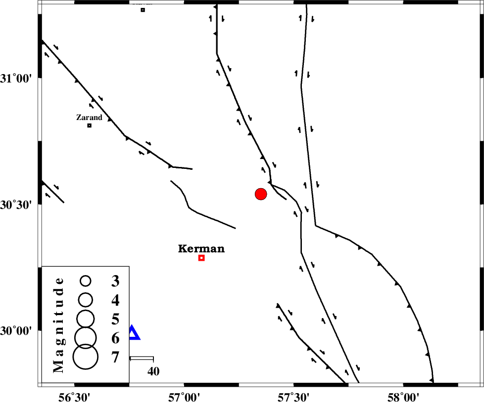
| Location | Lat:30.54 Lon: 57.35 |
| Region | Kerman Province, 39 km North-East of Kerman |
Nearest Cities |
|
| 8 km North of Dehlulu, Kerman Province | |
| 24 km South East of Harjand, Kerman Province | |
| 35 km North East of Sarasiyab-e ferangi, Kerman Province | |
| 37 km North West of Shahdad, Kerman Province | |
| 38 km North East of Kerman, Kerman Province | |
| Depth | 14 km |
| Agency | |
Faults within 150 km: |
|
| LAKARKUH_F (Length: 138 km) , Distance to epicenter: 6 km | |
| GOLBAF_SIRCH_F (Length: 114 km) , Distance to epicenter: 6 km | |
| CHATRUD_F (Length: 37 km) , Distance to epicenter: 19 km | |
| Number of Phases | 5 |
| RMS | 0.1 |
| Number of Stations | 4 |
| Error in Latitude | >2 km |
| Error in Longitude | 3.2 km |
| Error in Depth | 6.3 km |
Download waveform in seisan format
to download seisan software Click here
to access information about IIEES stations Click here
Amplitude | ||||||||
| UID | Agency | Station | Component | Amplitude | Period | Arrival Time | Proccessing Time | Signal Clip |
| 89870 | IIEES | TABS | N | 96.4 | 0.32 | 2013-07-10 23:55:22 | 2013-07-11 01:12:00 | n |
Phase | ||||||||||||
| Agency | Station | Component | Phase Type | Phase Quality | First Motion | Observed Arrival Time | Time Residual | Loc. Flag | Input Weight | Distance | Azimuth | |
| IIEES | KRBR | Z | Pg | E | 2013-07-10 23:53:49 | -0.01 | y | 84.2 | 223 | |||
| IIEES | BSRN | Z | Pn | E | 2013-07-10 23:54:11 | -0.08 | y | 231 | 46 | |||
| IIEES | YZKH | Z | Pn | E | 2013-07-10 23:54:24 | 0.08 | y | 333 | 309 | |||
| IIEES | YZKH | N | Sg | E | 2013-07-10 23:55:08 | -0.07 | y | 333 | 309 | |||
| IIEES | TABS | Z | P | E | 2013-07-10 23:54:25 | 0.1 | y | 345 | 356 | |||