
Magnitude |
3.1 |
| Date & Time (UTC) | 2013-07-12 19:13:08.7 |
| Date & Time (Local) | 1392/4/21 23:43:08.7 |
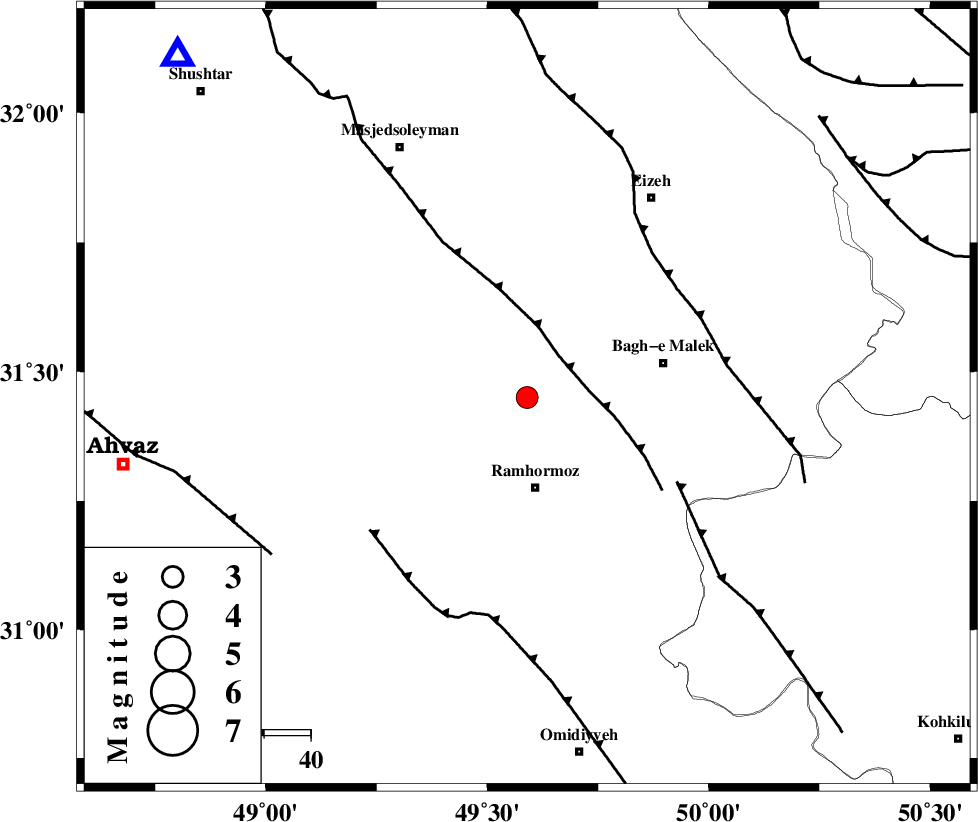
| Location | Lat:31.45 Lon: 49.59 |
| Region | Khoozestan Province, 20 km North of Ramhormoz |
Nearest Cities |
|
| 6 km North of Haftgol, Khoozestan Province | |
| 11 km North West of Midavood-e sofla, Khoozestan Province | |
| 12 km of Jaru, Khoozestan Province | |
| 19 km North of Ramhormoz, Khoozestan Province | |
| 23 km South East of Gazin, Khoozestan Province | |
| Depth | 14 km |
| Agency | |
Faults within 150 km: |
|
| DEZFUL_EMBAYMENT (Length: 228 km) , Distance to epicenter: 11 km | |
| MFF4 (Length: 62 km) , Distance to epicenter: 37 km | |
| MFF2 (Length: 205 km) , Distance to epicenter: 40 km | |
| Number of Phases | 6 |
| RMS | 0.1 |
| Number of Stations | 5 |
| Error in Latitude | >3.3 km |
| Error in Longitude | 3.7 km |
| Error in Depth | 5.8 km |
Download waveform in seisan format
to download seisan software Click here
to access information about IIEES stations Click here
Amplitude | ||||||||
| UID | Agency | Station | Component | Amplitude | Period | Arrival Time | Proccessing Time | Signal Clip |
| 89880 | IIEES | SHGR | E | 652.2 | 0.32 | 2013-07-12 19:13:42 | 2013-07-12 08:37:00 | n |
| 89881 | IIEES | KHMZ | E | 105.5 | 0.56 | 2013-07-12 19:14:27 | 2013-07-12 08:37:00 | n |
Phase | ||||||||||||
| Agency | Station | Component | Phase Type | Phase Quality | First Motion | Observed Arrival Time | Time Residual | Loc. Flag | Input Weight | Distance | Azimuth | |
| IIEES | SHGR | Z | Pg | E | 2013-07-12 19:13:26 | -0.04 | y | 104 | 315 | |||
| IIEES | KHMZ | Z | Pn | E | 2013-07-12 19:13:48 | 0.17 | y | 256 | 8 | |||
| IIEES | KHMZ | E | Sg | E | 2013-07-12 19:14:21 | -0.02 | y | 256 | 8 | |||
| IIEES | NASN | Z | Pn | E | 2013-07-12 19:13:58 | -0.02 | y | 339 | 63 | |||
| IIEES | ASAO | Z | Pn | E | 2013-07-12 19:13:59 | -0.03 | y | 346 | 7 | |||
| IIEES | GHVR | Z | Pn | E | 2013-07-12 19:14:02 | -0.09 | y | 370 | 24 | |||