
Magnitude |
2 |
| Date & Time (UTC) | 2013-07-13 16:03:12.9 |
| Date & Time (Local) | 1392/4/22 20:33:12.9 |
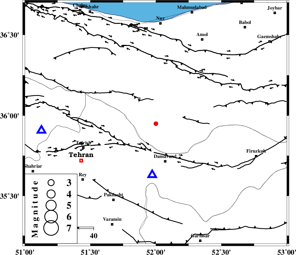
| Location | Lat:35.95 Lon: 52 |
| Region | Mazandaran Province, 27 km North of Damavand |
Nearest Cities |
|
| 16 km North West of Rineh, Mazandaran Province | |
| 18 km North West of Gaznak, Mazandaran Province | |
| 20 km North of Abali, Tehran Province | |
| 26 km North East of Bumehen, Tehran Province | |
| 26 km South of Pil, Mazandaran Province | |
| Depth | 23 km |
| Agency | |
Faults within 150 km: |
|
| MOSHA_F (Length: 234 km) , Distance to epicenter: 22 km | |
| N_TEHRAN_F4 (Length: 115 km) , Distance to epicenter: 24 km | |
| KANDOVAN_F (Length: 90 km) , Distance to epicenter: 25 km | |
| Number of Phases | 4 |
| RMS | 0 |
| Number of Stations | 3 |
| Error in Latitude | >4.8 km |
| Error in Longitude | 7.6 km |
| Error in Depth | 5.4 km |
Download waveform in seisan format
to download seisan software Click here
to access information about IIEES stations Click here
Amplitude | ||||||||
| UID | Agency | Station | Component | Amplitude | Period | Arrival Time | Proccessing Time | Signal Clip |
| 89893 | IIEES | DAMV | E | 226.2 | 0.12 | 2013-07-13 16:03:26 | 2013-07-13 06:18:00 | n |
| 89894 | IIEES | GHVR | N | 13.1 | 0.24 | 2013-07-13 16:04:11 | 2013-07-13 06:18:00 | n |
| 89895 | IIEES | GHVR | E | 13.1 | 0.72 | 2013-07-13 16:04:11 | 2013-07-13 06:18:00 | n |
Phase | ||||||||||||
| Agency | Station | Component | Phase Type | Phase Quality | First Motion | Observed Arrival Time | Time Residual | Loc. Flag | Input Weight | Distance | Azimuth | |
| IIEES | DAMV | Z | Pg | E | 2013-07-13 16:03:20 | 0.01 | y | 35.5 | 184 | |||
| IIEES | DAMV | E | Sg | E | 2013-07-13 16:03:25 | 0 | y | 35.5 | 184 | |||
| IIEES | CHTH | Z | Pg | E | 2013-07-13 16:03:26 | 0.01 | y | 79 | 267 | |||
| IIEES | GHVR | Z | Pg | E | 2013-07-13 16:03:41 | -0.01 | y | 177 | 203 | |||