
Magnitude |
3.4 |
| Date & Time (UTC) | 2013-07-14 15:15:55.5 |
| Date & Time (Local) | 1392/4/23 19:45:55.5 |
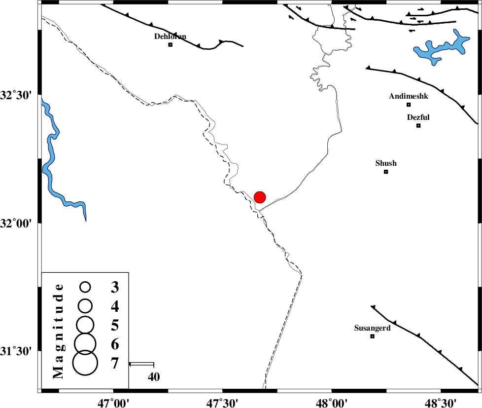
| Location | Lat:32.1 Lon: 47.67 |
| Region | Ilam Province, 55 km West of Shush |
Nearest Cities |
|
| 51 km North West of Bostan, Khoozestan Province | |
| 56 km South West of Shush, Khoozestan Province | |
| 58 km South East of Musian, Ilam Province | |
| 58 km West of Amaleh teimur, Khoozestan Province | |
| 74 km North West of Abdolkhan-eali, Khoozestan Province | |
| Depth | 18 km |
| Agency | |
Faults within 150 km: |
|
| MFF6 (Length: 144 km) , Distance to epicenter: 65 km | |
| AHVAZ_F (Length: 99 km) , Distance to epicenter: 67 km | |
| DEZFUL_EMBAYMENT (Length: 228 km) , Distance to epicenter: 72 km | |
| Number of Phases | 5 |
| RMS | 0.1 |
| Number of Stations | 4 |
| Error in Latitude | >3 km |
| Error in Longitude | 5.3 km |
| Error in Depth | 6.4 km |
Download waveform in seisan format
to download seisan software Click here
to access information about IIEES stations Click here
Amplitude | ||||||||
| UID | Agency | Station | Component | Amplitude | Period | Arrival Time | Proccessing Time | Signal Clip |
| 89896 | IIEES | SHGR | N | 1166.4 | 0.92 | 2013-07-14 15:16:34 | 2013-07-14 05:09:00 | n |
Phase | ||||||||||||
| Agency | Station | Component | Phase Type | Phase Quality | First Motion | Observed Arrival Time | Time Residual | Loc. Flag | Input Weight | Distance | Azimuth | |
| IIEES | SHGR | Z | Pg | E | 2013-07-14 15:16:13 | 0.03 | y | 106 | 89 | |||
| IIEES | KHMZ | Z | Pn | E | 2013-07-14 15:16:37 | -0.16 | y | 281 | 49 | |||
| IIEES | KHMZ | E | Sg | E | 2013-07-14 15:17:14 | 0 | y | 281 | 49 | |||
| IIEES | SNGE | Z | Pn | E | 2013-07-14 15:16:44 | 0.07 | y | 333 | 355 | |||
| IIEES | ASAO | Z | Pn | E | 2013-07-14 15:16:46 | 0.07 | y | 349 | 38 | |||