
Magnitude |
3.3 |
| Date & Time (UTC) | 2013-07-21 18:06:14.7 |
| Date & Time (Local) | 1392/4/30 22:36:14.7 |
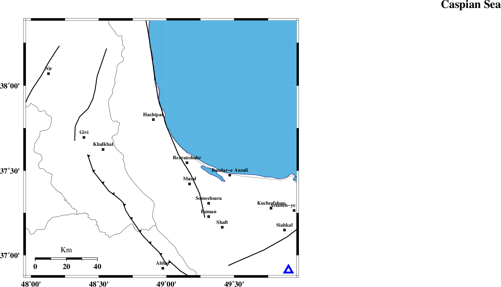
| Location | Lat:37.63 Lon: 48.96 |
| Region | Gilan Province, 20 km South of Hashtpar |
Nearest Cities |
|
| 10 km North West of Void, Gilan Province | |
| 11 km North West of Parrehsar, Gilan Province | |
| 11 km North of Ardeh, Gilan Province | |
| 14 km South of Tularud, Gilan Province | |
| 19 km South of Hashtpar, Gilan Province | |
| Depth | 14 km |
| Agency | |
Faults within 150 km: |
|
| TALESH_F (Length: 258 km) , Distance to epicenter: 12 km | |
| MASULEL_F (Length: 90 km) , Distance to epicenter: 43 km | |
| SANGAVAR_F (Length: 61 km) , Distance to epicenter: 54 km | |
| Number of Phases | 6 |
| RMS | 0 |
| Number of Stations | 4 |
| Error in Latitude | >2.4 km |
| Error in Longitude | 3.5 km |
| Error in Depth | 3.7 km |
Download waveform in seisan format
to download seisan software Click here
to access information about IIEES stations Click here
Amplitude | ||||||||
| UID | Agency | Station | Component | Amplitude | Period | Arrival Time | Proccessing Time | Signal Clip |
| 89952 | IIEES | GRMI | E | 591.6 | 0.48 | 2013-07-21 18:07:02 | 2013-07-22 12:45:00 | n |
| 89953 | IIEES | GRMI | N | 354.7 | 0.48 | 2013-07-21 18:07:03 | 2013-07-22 12:45:00 | n |
Phase | ||||||||||||
| Agency | Station | Component | Phase Type | Phase Quality | First Motion | Observed Arrival Time | Time Residual | Loc. Flag | Input Weight | Distance | Azimuth | |
| IIEES | GRMI | Z | Pg | E | 2013-07-21 18:06:41 | -0.03 | y | 161 | 325 | |||
| IIEES | GRMI | N | Sg | E | 2013-07-21 18:07:00 | 0.03 | y | 161 | 325 | |||
| IIEES | THKV | Z | Pn | E | 2013-07-21 18:06:54 | -0.02 | y | 256 | 137 | |||
| IIEES | THKV | E | Sg | E | 2013-07-21 18:07:27 | 0.01 | y | 256 | 137 | |||
| IIEES | SNGE | Z | Pn | E | 2013-07-21 18:07:01 | -0.02 | y | 316 | 208 | |||
| IIEES | ASAO | Z | Pn | E | 2013-07-21 18:07:06 | 0.05 | y | 355 | 164 | |||