
Magnitude |
3.1 |
| Date & Time (UTC) | 2013-07-22 04:38:54.0 |
| Date & Time (Local) | 1392/4/31 09:08:54.0 |
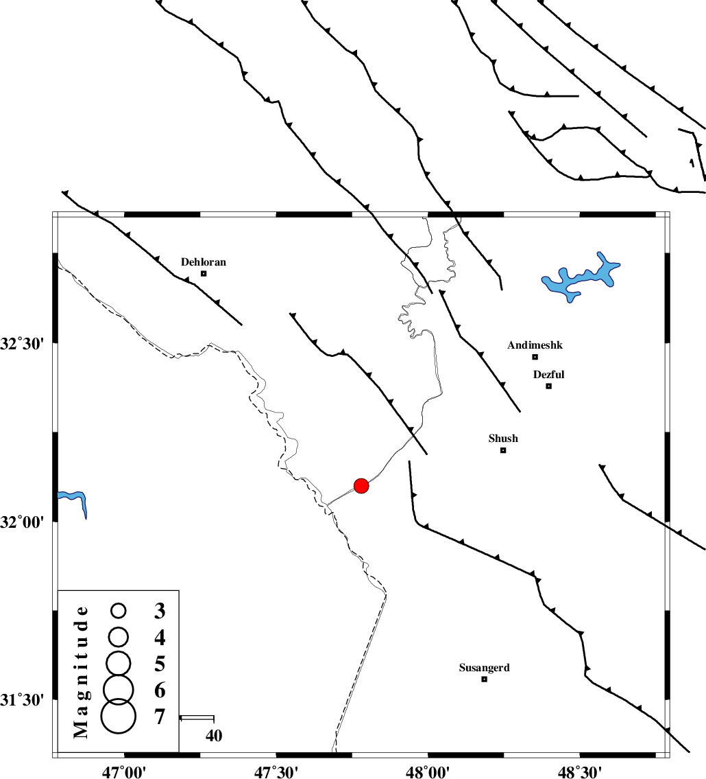
| Location | Lat:32.1 Lon: 47.78 |
| Region | Khoozestan Province, 45 km South-West of Shush |
Nearest Cities |
|
| 45 km South West of Shush, Khoozestan Province | |
| 46 km North West of Bostan, Khoozestan Province | |
| 48 km West of Amaleh teimur, Khoozestan Province | |
| 63 km South East of Musian, Ilam Province | |
| 65 km North West of Abdolkhan-eali, Khoozestan Province | |
| Depth | 14 km |
| Agency | |
Faults within 150 km: |
|
| AHVAZ_F (Length: 99 km) , Distance to epicenter: 60 km | |
| DEZFUL_EMBAYMENT (Length: 228 km) , Distance to epicenter: 66 km | |
| MFF6 (Length: 144 km) , Distance to epicenter: 67 km | |
| Number of Phases | 8 |
| RMS | 0.2 |
| Number of Stations | 6 |
| Error in Latitude | >3.2 km |
| Error in Longitude | 7.8 km |
| Error in Depth | 9.1 km |
Download waveform in seisan format
to download seisan software Click here
to access information about IIEES stations Click here
Amplitude | ||||||||
| UID | Agency | Station | Component | Amplitude | Period | Arrival Time | Proccessing Time | Signal Clip |
| 89954 | IIEES | SHGR | E | 593.9 | 0.45 | 2013-07-22 04:39:28 | 2013-07-22 06:41:00 | n |
Phase | ||||||||||||
| Agency | Station | Component | Phase Type | Phase Quality | First Motion | Observed Arrival Time | Time Residual | Loc. Flag | Input Weight | Distance | Azimuth | |
| IIEES | SHGR | Z | Pg | E | 2013-07-22 04:39:10 | -0.18 | y | 96.2 | 89 | |||
| IIEES | SHGR | N | Sg | E | 2013-07-22 04:39:22 | 0.24 | y | 96.2 | 89 | |||
| IIEES | KHMZ | Z | Pn | E | 2013-07-22 04:39:35 | -0.01 | y | 273 | 48 | |||
| IIEES | KHMZ | N | Sg | E | 2013-07-22 04:40:11 | -0.17 | y | 273 | 48 | |||
| IIEES | ASAO | Z | Pn | E | 2013-07-22 04:39:44 | 0.35 | y | 343 | 37 | |||
| IIEES | GHVR | Z | Pn | E | 2013-07-22 04:39:53 | 0.09 | y | 417 | 50 | |||
| IIEES | NASN | Z | Pn | E | 2013-07-22 04:40:01 | -0.35 | y | 479 | 79 | |||
| IIEES | GHIR | Z | Pn | E | 2013-07-22 04:40:23 | -0.01 | y | 655 | 129 | |||