
Magnitude |
2.2 |
| Date & Time (UTC) | 2013-07-22 18:24:54.1 |
| Date & Time (Local) | 1392/4/31 22:54:54.1 |
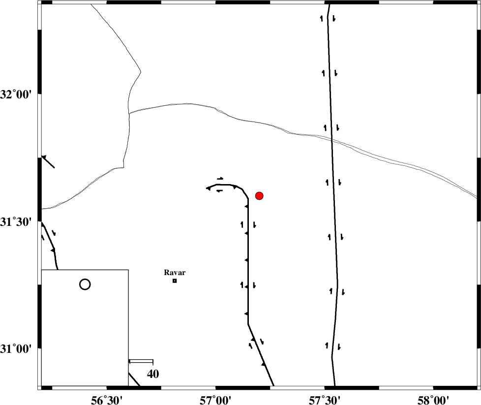
| Location | Lat:31.6 Lon: 57.2 |
| Region | Kerman Province, 52 km North-East of Ravar |
Nearest Cities |
|
| 49 km North East of Dehali, Kerman Province | |
| 52 km North East of Ravar, Kerman Province | |
| 66 km South West of Hoz-e qorban, Yazd Province | |
| 85 km North East of Ahmadi, Kerman Province | |
| 85 km North East of Dasht-e khak, Kerman Province | |
| Depth | 18 km |
| Agency | |
Faults within 150 km: |
|
| LAKARKUH_F (Length: 138 km) , Distance to epicenter: 5 km | |
| NAYBAND_F (Length: 258 km) , Distance to epicenter: 34 km | |
| JAFARABAD_F (Length: 60 km) , Distance to epicenter: 90 km | |
| Number of Phases | 6 |
| RMS | 0.2 |
| Number of Stations | 4 |
| Error in Latitude | >2.7 km |
| Error in Longitude | 3.2 km |
| Error in Depth | 7.3 km |
Download waveform in seisan format
to download seisan software Click here
to access information about IIEES stations Click here
Amplitude | ||||||||
| UID | Agency | Station | Component | Amplitude | Period | Arrival Time | Proccessing Time | Signal Clip |
| 89970 | IIEES | KRBR | E | 28.3 | 0.2 | 2013-07-22 18:25:48 | 2013-07-23 03:05:00 | n |
| 89971 | IIEES | KRBR | N | 25.2 | 0.28 | 2013-07-22 18:25:51 | 2013-07-23 03:05:00 | n |
Phase | ||||||||||||
| Agency | Station | Component | Phase Type | Phase Quality | First Motion | Observed Arrival Time | Time Residual | Loc. Flag | Input Weight | Distance | Azimuth | |
| IIEES | KRBR | Z | Pn | E | 2013-07-22 18:25:24 | -0.17 | y | 184 | 193 | |||
| IIEES | KRBR | N | Sg | E | 2013-07-22 18:25:47 | 0.18 | y | 184 | 193 | |||
| IIEES | BSRN | Z | Pn | E | 2013-07-22 18:25:24 | -0.03 | y | 187 | 77 | |||
| IIEES | BSRN | N | Sg | E | 2013-07-22 18:25:47 | -0.07 | y | 187 | 77 | |||
| IIEES | TABS | N | Pn | E | 2013-07-22 18:25:30 | 0.35 | y | 228 | 358 | |||
| IIEES | YZKH | Z | Pn | E | 2013-07-22 18:25:33 | -0.26 | y | 262 | 290 | |||