
Magnitude |
3.5 |
| Date & Time (UTC) | 2013-07-25 09:30:53.0 |
| Date & Time (Local) | 1392/5/3 14:00:53.0 |
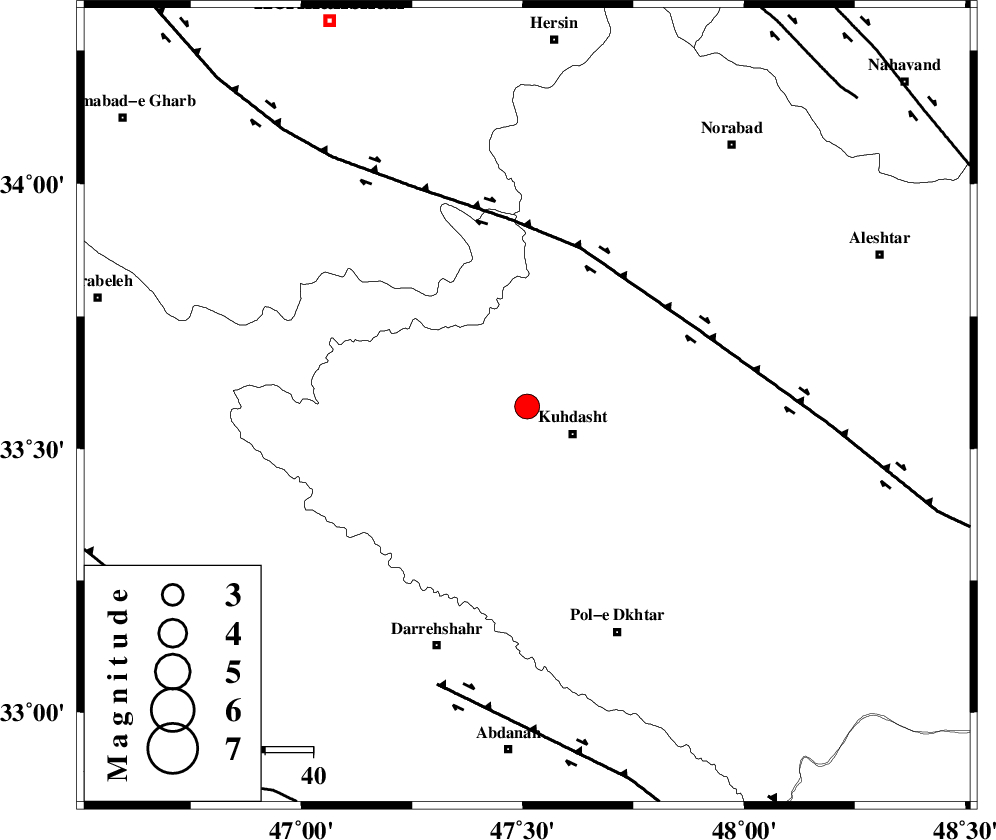
| Location | Lat:33.58 Lon: 47.51 |
| Region | Lorestan Province, 11 km Kuhdasht |
Nearest Cities |
|
| 10 km North of Ashtarheh golgol, Lorestan Province | |
| 11 km North West of Kuhdasht, Lorestan Province | |
| 25 km North East of Kunani, Lorestan Province | |
| 27 km North East of Garab, Lorestan Province | |
| 29 km North of Suri, Lorestan Province | |
| Depth | 14 km |
| Agency | |
Faults within 150 km: |
|
| HZF4 (Length: 492 km) , Distance to epicenter: 35 km | |
| BALARUD_F_Z1 (Length: 87 km) , Distance to epicenter: 61 km | |
| SAHANEH_F (Length: 77 km) , Distance to epicenter: 94 km | |
| Number of Phases | 4 |
| RMS | 0.1 |
| Number of Stations | 4 |
| Error in Latitude | >8.7 km |
| Error in Longitude | 5.8 km |
| Error in Depth | 5.8 km |
Download waveform in seisan format
to download seisan software Click here
to access information about IIEES stations Click here
Amplitude | ||||||||
| UID | Agency | Station | Component | Amplitude | Period | Arrival Time | Proccessing Time | Signal Clip |
| 89998 | IIEES | KHMZ | E | 310.3 | 0.44 | 2013-07-25 09:32:08 | 2013-07-25 10:59:00 | n |
| 89999 | IIEES | GHVR | N | 117.8 | 0.68 | 2013-07-25 09:32:51 | 2013-07-25 10:59:00 | n |
Phase | ||||||||||||
| Agency | Station | Component | Phase Type | Phase Quality | First Motion | Observed Arrival Time | Time Residual | Loc. Flag | Input Weight | Distance | Azimuth | |
| IIEES | SNGE | Z | Pg | E | 2013-07-25 09:31:20 | -0.06 | y | 168 | 355 | |||
| IIEES | KHMZ | Z | Pg | E | 2013-07-25 09:31:30 | -0.15 | y | 228 | 85 | |||
| IIEES | KHMZ | E | Sg | E | 2013-07-25 09:31:57 | 0 | y | 228 | 85 | |||
| IIEES | ASAO | Z | Pn | E | 2013-07-25 09:31:32 | 0.2 | y | 256 | 64 | |||