
Magnitude |
3.3 |
| Date & Time (UTC) | 2013-07-29 01:38:44.9 |
| Date & Time (Local) | 1392/5/7 06:08:44.9 |
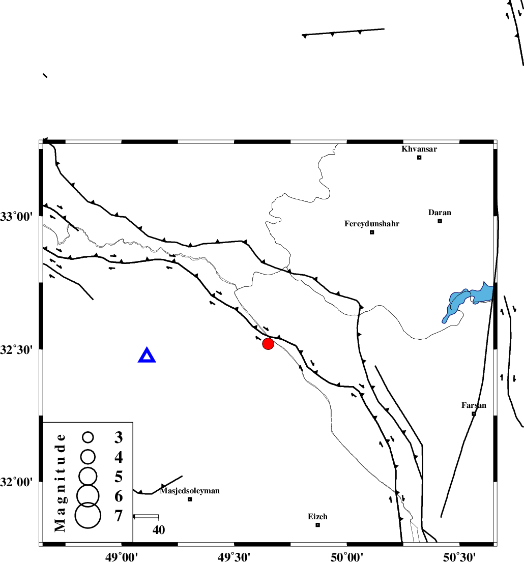
| Location | Lat:32.52 Lon: 49.65 |
| Region | Khoozestan Province, 45 km West of Chelgard |
Nearest Cities |
|
| 27 km North of Paabshalal, Khoozestan Province | |
| 28 km South West of Durak, Chaharmahal Bakhtiari Province | |
| 40 km North East of Qale-yekhvaju, Khoozestan Province | |
| 41 km South West of Masir, Esfahan Province | |
| 45 km North West of Chelgard, Chaharmahal Bakhtiari Province | |
| Depth | 14 km |
| Agency | |
Faults within 150 km: |
|
| ZARDKUH_F (Length: 139 km) , Distance to epicenter: 16 km | |
| ARDAL_F (Length: 170 km) , Distance to epicenter: 27 km | |
| MFF2 (Length: 205 km) , Distance to epicenter: 34 km | |
| Number of Phases | 7 |
| RMS | 0 |
| Number of Stations | 7 |
| Error in Latitude | >3.2 km |
| Error in Longitude | 3.4 km |
| Error in Depth | 6.1 km |
Download waveform in seisan format
to download seisan software Click here
to access information about IIEES stations Click here
Amplitude | ||||||||
| UID | Agency | Station | Component | Amplitude | Period | Arrival Time | Proccessing Time | Signal Clip |
| 90027 | IIEES | KHMZ | E | 437 | 0.4 | 2013-07-29 01:39:29 | 2013-07-29 03:07:00 | n |
| 90028 | IIEES | ASAO | E | 232.6 | 0.52 | 2013-07-29 01:39:53 | 2013-07-29 03:07:00 | n |
| 90029 | IIEES | GHVR | N | 156.2 | 0.68 | 2013-07-29 01:40:02 | 2013-07-29 03:07:00 | n |
Phase | ||||||||||||
| Agency | Station | Component | Phase Type | Phase Quality | First Motion | Observed Arrival Time | Time Residual | Loc. Flag | Input Weight | Distance | Azimuth | |
| IIEES | ASAO | Z | Pn | E | 2013-07-29 01:39:21 | 0 | y | 227 | 9 | |||
| IIEES | ASAO | E | Sg | E | 2013-07-29 01:39:49 | 0.01 | y | 227 | 9 | |||
| IIEES | NASN | Z | Pn | E | 2013-07-29 01:39:29 | 0.03 | y | 298 | 83 | |||
| IIEES | NASN | E | Sg | E | 2013-07-29 01:40:09 | -0.01 | y | 298 | 83 | |||
| IIEES | SNGE | Z | Pn | E | 2013-07-29 01:39:36 | -0.03 | y | 356 | 324 | |||
| IIEES | CHTH | Z | Pn | E | 2013-07-29 01:39:42 | 0.01 | y | 399 | 20 | |||
| IIEES | YZKH | Z | Pn | E | 2013-07-29 01:39:50 | -0.01 | y | 465 | 91 | |||