
Magnitude |
1.5 |
| Date & Time (UTC) | 2013-07-29 13:41:56.5 |
| Date & Time (Local) | 1392/5/7 18:11:56.5 |
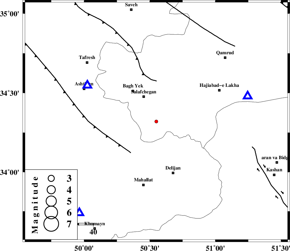
| Location | Lat:34.32 Lon: 50.55 |
| Region | Qom Province, 38 km North-West of Delijan |
Nearest Cities |
|
| 20 km South of Salafchegan, Qom Province | |
| 21 km North of Dudhak, Markazi Province | |
| 27 km South East of Bagh yek, Qom Province | |
| 28 km North of Khorheh, Markazi Province | |
| 30 km West of Kahak, Qom Province | |
| Depth | 10 km |
| Agency | |
Faults within 150 km: |
|
| TAFRESH_F (Length: 117 km) , Distance to epicenter: 28 km | |
| INDES_F (Length: 98 km) , Distance to epicenter: 28 km | |
| KASHAN_F (Length: 44 km) , Distance to epicenter: 69 km | |
| Number of Phases | 5 |
| RMS | 0.1 |
| Number of Stations | 4 |
| Error in Latitude | >1.9 km |
| Error in Longitude | 2.1 km |
| Error in Depth | 4.2 km |
Download waveform in seisan format
to download seisan software Click here
to access information about IIEES stations Click here
Amplitude | ||||||||
| UID | Agency | Station | Component | Amplitude | Period | Arrival Time | Proccessing Time | Signal Clip |
| 90034 | IIEES | GHVR | E | 33.9 | 0.24 | 2013-07-29 13:42:23 | 2013-07-29 04:06:00 | n |
| 90035 | IIEES | GHVR | N | 24.1 | 0.44 | 2013-07-29 13:42:28 | 2013-07-29 04:06:00 | n |
| 90036 | IIEES | KHMZ | N | 22.5 | 0.32 | 2013-07-29 13:42:23 | 2013-07-29 04:06:00 | n |
Phase | ||||||||||||
| Agency | Station | Component | Phase Type | Phase Quality | First Motion | Observed Arrival Time | Time Residual | Loc. Flag | Input Weight | Distance | Azimuth | |
| IIEES | ASAO | Z | Pg | E | 2013-07-29 13:42:06 | 0.02 | y | 54.4 | 298 | |||
| IIEES | GHVR | Z | Pg | E | 2013-07-29 13:42:08 | 0.04 | y | 66.4 | 74 | |||
| IIEES | KHMZ | Z | Pg | E | 2013-07-29 13:42:11 | -0.2 | y | 84.1 | 220 | |||
| IIEES | KHMZ | N | Sg | E | 2013-07-29 13:42:22 | 0.14 | y | 84.1 | 220 | |||
| IIEES | CHTH | Z | Pn | E | 2013-07-29 13:42:27 | 0.01 | y | 184 | 16 | |||