
Magnitude |
3.5 |
| Date & Time (UTC) | 2013-08-05 18:51:12.2 |
| Date & Time (Local) | 1392/5/14 23:21:12.2 |
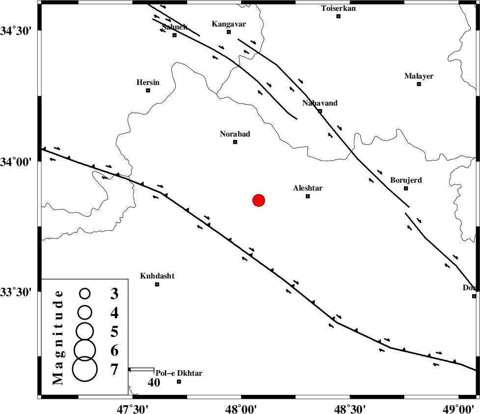
| Location | Lat:33.85 Lon: 48.08 |
| Region | Lorestan Province, 21 km West of Aleshtar |
Nearest Cities |
|
| 8 km of Firuz Abad, Lorestan Province | |
| 15 km South of Farhadabad, Lorestan Province | |
| 18 km West of Dehrahim, Lorestan Province | |
| 21 km North West of Siyahpush, Lorestan Province | |
| 21 km West of Aleshtar, Lorestan Province | |
| Depth | 18 km |
| Agency | |
Faults within 150 km: |
|
| HZF4 (Length: 492 km) , Distance to epicenter: 22 km | |
| SAHANEH_F (Length: 77 km) , Distance to epicenter: 38 km | |
| NAHAVAND_F (Length: 102 km) , Distance to epicenter: 44 km | |
| Number of Phases | 4 |
| RMS | 0 |
| Number of Stations | 5 |
| Error in Latitude | >1.9 km |
| Error in Longitude | 3 km |
| Error in Depth | 4.4 km |
Download waveform in seisan format
to download seisan software Click here
to access information about IIEES stations Click here
Amplitude | ||||||||
| UID | Agency | Station | Component | Amplitude | Period | Arrival Time | Proccessing Time | Signal Clip |
| 90127 | IIEES | KHMZ | N | 611.4 | 0.68 | 2013-08-05 18:52:08 | 2013-08-05 08:13:00 | n |
| 90128 | IIEES | KHMZ | E | 485.8 | 0.44 | 2013-08-05 18:52:10 | 2013-08-05 08:13:00 | n |
| 90129 | IIEES | SHGR | N | 515.5 | 0.52 | 2013-08-05 18:52:21 | 2013-08-05 08:13:00 | n |
| 90130 | IIEES | GHVR | N | 195.7 | 0.56 | 2013-08-05 18:52:48 | 2013-08-05 08:13:00 | n |
| 90131 | IIEES | GHVR | E | 214 | 0.76 | 2013-08-05 18:52:50 | 2013-08-05 08:13:00 | n |
Phase | ||||||||||||
| Agency | Station | Component | Phase Type | Phase Quality | First Motion | Observed Arrival Time | Time Residual | Loc. Flag | Input Weight | Distance | Azimuth | |
| IIEES | SNGE | Z | Pg | E | 2013-08-05 18:51:37 | 0 | y | 153 | 334 | |||
| IIEES | KHMZ | Z | Pg | E | 2013-08-05 18:51:41 | 0.01 | y | 175 | 94 | |||
| IIEES | ASAO | Z | Pn | E | 2013-08-05 18:51:43 | 0 | y | 195 | 66 | |||
| IIEES | SHGR | Z | Pg | E | 2013-08-05 18:51:45 | -0.01 | y | 205 | 161 | |||