
Magnitude |
2.2 |
| Date & Time (UTC) | 2013-08-07 19:10:10.4 |
| Date & Time (Local) | 1392/5/16 23:40:10.4 |
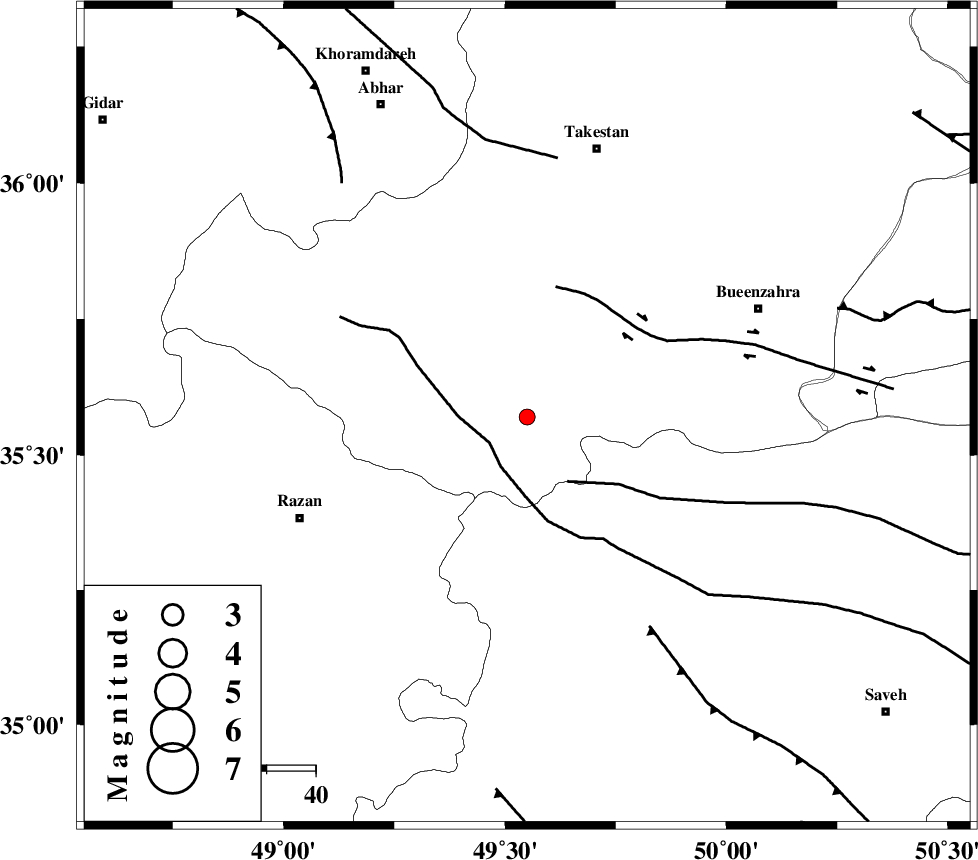
| Location | Lat:35.57 Lon: 49.55 |
| Region | Ghazvin Province, 57 km South-West of Takestan |
Nearest Cities |
|
| 9 km of Kolanjin, Ghazvin Province | |
| 28 km East of Avaj, Ghazvin Province | |
| 29 km South West of Danesfahan, Ghazvin Province | |
| 31 km North West of Duzaj, Markazi Province | |
| 31 km South East of Ab-e garm, Ghazvin Province | |
| Depth | 14 km |
| Agency | |
Faults within 150 km: |
|
| KUSHK_E_NOSRAT_F (Length: 230 km) , Distance to epicenter: 9 km | |
| S_PARANDAK_F (Length: 116 km) , Distance to epicenter: 16 km | |
| IPAK_F (Length: 80 km) , Distance to epicenter: 27 km | |
| Number of Phases | 5 |
| RMS | 0.1 |
| Number of Stations | 5 |
| Error in Latitude | >1.4 km |
| Error in Longitude | 3 km |
| Error in Depth | 4.6 km |
Download waveform in seisan format
to download seisan software Click here
to access information about IIEES stations Click here
Amplitude | ||||||||
| UID | Agency | Station | Component | Amplitude | Period | Arrival Time | Proccessing Time | Signal Clip |
| 90158 | IIEES | THKV | E | 49.4 | 0.56 | 2013-08-07 19:10:53 | 2013-08-08 04:25:00 | n |
| 90159 | IIEES | GHVR | E | 22 | 0.44 | 2013-08-07 19:11:15 | 2013-08-08 04:25:00 | n |
Phase | ||||||||||||
| Agency | Station | Component | Phase Type | Phase Quality | First Motion | Observed Arrival Time | Time Residual | Loc. Flag | Input Weight | Distance | Azimuth | |
| IIEES | ASAO | Z | Pg | E | 2013-08-07 19:10:30 | 0.08 | y | 121 | 159 | |||
| IIEES | ASAO | E | Sg | E | 2013-08-07 19:10:45 | -0.14 | y | 121 | 159 | |||
| IIEES | THKV | Z | Pg | E | 2013-08-07 19:10:31 | 0 | y | 126 | 72 | |||
| IIEES | ZNJK | Z | Pg | E | 2013-08-07 19:10:34 | -0.06 | y | 145 | 328 | |||
| IIEES | KHMZ | Z | Pn | E | 2013-08-07 19:10:44 | 0.11 | y | 206 | 169 | |||