
Magnitude |
3 |
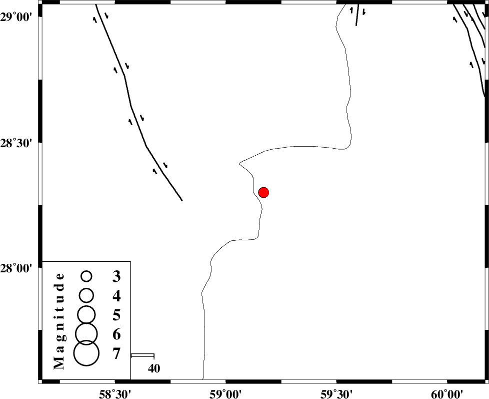
| Date & Time (UTC) | 2013-08-08 16:26:41.3 |
| Date & Time (Local) | 1392/5/17 20:56:41.3 |
| Location | Lat:28.3 Lon: 59.17 |
| Region | Sistan va Baloochestan Province, 119 km South-East of Bam |
Nearest Cities |
|
| 46 km South East of Hoseynabad, Kerman Province | |
| 55 km South East of Mohammadabad-e gonbaki, Kerman Province | |
| 69 km South East of Void, Kerman Province | |
| 71 km North East of Borj-e abbasabad, Kerman Province | |
| 78 km South East of Fahroj, Kerman Province | |
| Depth | 14 km |
| Agency | |
Faults within 150 km: |
|
| BAM_F (Length: 118 km) , Distance to epicenter: 36 km | |
| KANURAK_F (Length: 135 km) , Distance to epicenter: 84 km | |
| DAMAN_F (Length: 167 km) , Distance to epicenter: 102 km | |
| Number of Phases | 5 |
| RMS | 0.1 |
| Number of Stations | 4 |
| Error in Latitude | >11.9 km |
| Error in Longitude | 1.4 km |
| Error in Depth | 11 km |
Download waveform in seisan format
to download seisan software Click here
to access information about IIEES stations Click here
Amplitude | ||||||||
| UID | Agency | Station | Component | Amplitude | Period | Arrival Time | Proccessing Time | Signal Clip |
| 90162 | IIEES | KRBR | E | 50.8 | 0.64 | 2013-08-08 16:28:11 | 2013-08-08 07:06:00 | n |
| 90163 | IIEES | BNDS | E | 65.1 | 0.44 | 2013-08-08 16:28:02 | 2013-08-08 07:06:00 | n |
| 90164 | IIEES | BNDS | N | 65.2 | 0.44 | 2013-08-08 16:28:04 | 2013-08-08 07:06:00 | n |
Phase | ||||||||||||
| Agency | Station | Component | Phase Type | Phase Quality | First Motion | Observed Arrival Time | Time Residual | Loc. Flag | Input Weight | Distance | Azimuth | |
| IIEES | ZHSF | Z | Pn | E | 2013-08-08 16:27:15 | -0.09 | y | 214 | 47 | |||
| IIEES | ZHSF | E | Sg | E | 2013-08-08 16:27:41 | -0.01 | y | 214 | 47 | |||
| IIEES | KRBR | Z | Pn | E | 2013-08-08 16:27:26 | 0.01 | y | 299 | 309 | |||
| IIEES | KRBR | N | Sg | E | 2013-08-08 16:28:05 | -0.06 | y | 299 | 309 | |||
| IIEES | BSRN | Z | Pn | E | 2013-08-08 16:27:39 | 0.19 | y | 406 | 359 | |||