
Magnitude |
4.6 |
| Date & Time (UTC) | 2013-08-14 19:50:07.1 |
| Date & Time (Local) | 1392/5/24 00:20:07.1 |
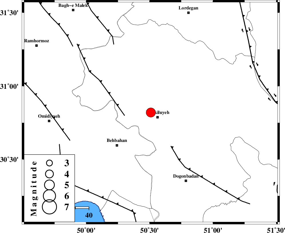
| Location | Lat:30.82 Lon: 50.51 |
| Region | Kohkiluieh va boyerahmad Province, 7 km Dehdasht |
Nearest Cities |
|
| 6 km North of Dehdasht, Kohkiluieh va boyerahmad Province | |
| 19 km South of Lendeh, Kohkiluieh va boyerahmad Province | |
| 25 km West of Savari, Kohkiluieh va boyerahmad Province | |
| 29 km North East of Mansuriyeh, Khoozestan Province | |
| 34 km North East of Dodange-ye bozorg, Khoozestan Province | |
| Depth | 18 km |
| Agency | |
Faults within 150 km: |
|
| MFF4 (Length: 62 km) , Distance to epicenter: 20 km | |
| MISHAN_F (Length: 76 km) , Distance to epicenter: 30 km | |
| MFF2 (Length: 205 km) , Distance to epicenter: 59 km | |
| Number of Phases | 7 |
| RMS | 0.2 |
| Number of Stations | 6 |
| Error in Latitude | >2.8 km |
| Error in Longitude | 1.9 km |
| Error in Depth | 5.9 km |
Download waveform in seisan format
to download seisan software Click here
to access information about IIEES stations Click here
Amplitude | ||||||||
| UID | Agency | Station | Component | Amplitude | Period | Arrival Time | Proccessing Time | Signal Clip |
| 90222 | IIEES | SHGR | N | 4165.8 | 0.88 | 2013-08-14 19:51:20 | 2013-08-14 09:21:00 | n |
| 90223 | IIEES | AHRM | E | 1839.4 | 0.48 | 2013-08-14 19:51:19 | 2013-08-14 09:21:00 | n |
| 90224 | IIEES | GHIR | E | 2908.3 | 0.96 | 2013-08-14 19:51:59 | 2013-08-14 09:21:00 | n |
Phase | ||||||||||||
| Agency | Station | Component | Phase Type | Phase Quality | First Motion | Observed Arrival Time | Time Residual | Loc. Flag | Input Weight | Distance | Azimuth | |
| IIEES | SHGR | Z | P | E | 2013-08-14 19:50:41 | -0.1 | y | 216 | 312 | |||
| IIEES | SHGR | N | Sg | E | 2013-08-14 19:51:08 | 0.01 | y | 216 | 312 | |||
| IIEES | AHRM | Z | Pn | E | 2013-08-14 19:50:43 | 0.24 | y | 230 | 160 | |||
| IIEES | NASN | Z | Pn | E | 2013-08-14 19:50:52 | -0.29 | y | 309 | 44 | |||
| IIEES | NASN | N | Sg | E | 2013-08-14 19:51:34 | 0.16 | y | 309 | 44 | |||
| IIEES | KHMZ | Z | Pn | E | 2013-08-14 19:50:55 | 0.14 | y | 327 | 351 | |||
| IIEES | YZKH | Z | Pn | E | 2013-08-14 19:51:07 | -0.21 | y | 425 | 65 | |||