
Magnitude |
3.3 |
| Date & Time (UTC) | 2013-08-17 03:40:03.2 |
| Date & Time (Local) | 1392/5/26 08:10:03.2 |
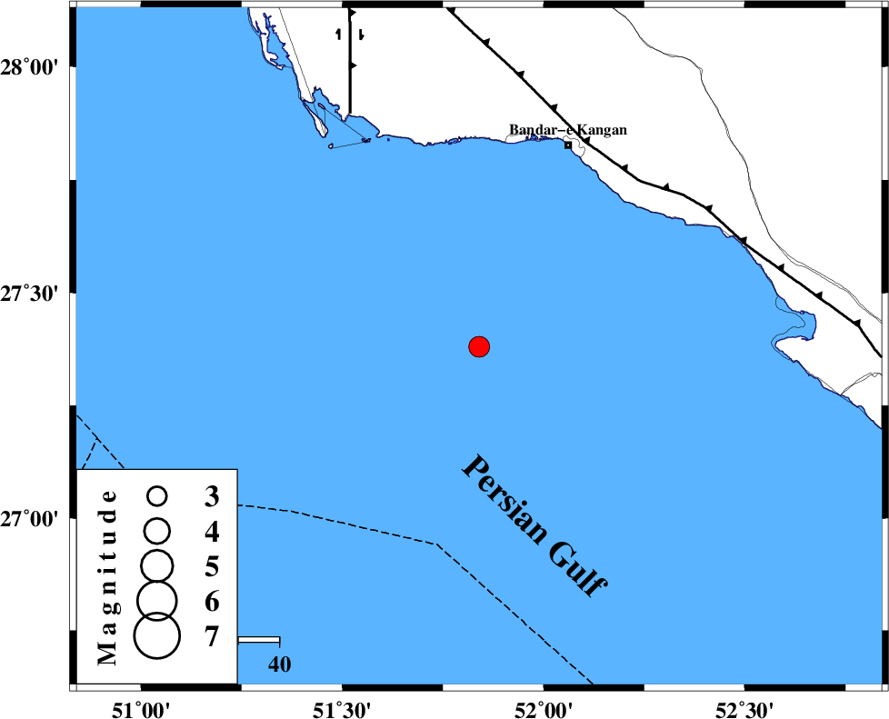
| Location | Lat:27.38 Lon: 51.84 |
| Region | Persian Gulf, 55 km South-West of Bandar-e kangan |
Nearest Cities |
|
| 54 km South West of Bandar-e kangan, Bushehr Province | |
| 59 km South West of Bandar-e taheri, Bushehr Province | |
| 69 km South West of Jam, Bushehr Province | |
| 76 km West of Bandar-e asaluyeh, Bushehr Province | |
| 77 km South West of Riz, Bushehr Province | |
| Depth | 40 km |
| Agency | |
Faults within 150 km: |
|
| MFF3 (Length: 292 km) , Distance to epicenter: 57 km | |
| BORAZJAN_F (Length: 168 km) , Distance to epicenter: 66 km | |
| ZFF2 (Length: 84 km) , Distance to epicenter: 97 km | |
| Number of Phases | 8 |
| RMS | 0.3 |
| Number of Stations | 6 |
| Error in Latitude | >6.9 km |
| Error in Longitude | 3.6 km |
| Error in Depth | 6.1 km |
Download waveform in seisan format
to download seisan software Click here
to access information about IIEES stations Click here
Amplitude | ||||||||
| UID | Agency | Station | Component | Amplitude | Period | Arrival Time | Proccessing Time | Signal Clip |
| 90245 | IIEES | GHIR | E | 213.2 | 0.73 | 2013-08-17 03:40:51 | 2013-08-17 05:46:00 | n |
| 90246 | IIEES | AHRM | N | 622.8 | 0.56 | 2013-08-17 03:40:54 | 2013-08-17 05:46:00 | n |
| 90247 | IIEES | AHRM | E | 257.9 | 0.76 | 2013-08-17 03:40:55 | 2013-08-17 05:46:00 | n |
| 90248 | IIEES | KRBR | E | 26.2 | 0.72 | 2013-08-17 03:42:23 | 2013-08-17 05:46:00 | n |
| 90249 | IIEES | KRBR | N | 29.8 | 0.79 | 2013-08-17 03:42:23 | 2013-08-17 05:46:00 | n |
Phase | ||||||||||||
| Agency | Station | Component | Phase Type | Phase Quality | First Motion | Observed Arrival Time | Time Residual | Loc. Flag | Input Weight | Distance | Azimuth | |
| IIEES | GHIR | Z | Pg | E | 2013-08-17 03:40:28 | -0.18 | y | 151 | 48 | |||
| IIEES | GHIR | E | Sg | E | 2013-08-17 03:40:46 | 0.13 | y | 151 | 48 | |||
| IIEES | AHRM | Z | Pg | E | 2013-08-17 03:40:31 | 0.24 | y | 173 | 342 | |||
| IIEES | AHRM | N | Sg | E | 2013-08-17 03:40:51 | -0.18 | y | 173 | 342 | |||
| IIEES | KRBR | Z | Pn | E | 2013-08-17 03:41:18 | -0.38 | y | 561 | 58 | |||
| IIEES | YZKH | Z | Pn | E | 2013-08-17 03:41:25 | 0.33 | y | 616 | 25 | |||
| IIEES | TABS | Z | Pn | E | 2013-08-17 03:41:55 | -0.29 | y | 860 | 35 | |||
| IIEES | BSRN | Z | Pn | E | 2013-08-17 03:41:57 | 0.43 | y | 869 | 52 | |||