
Magnitude |
3.7 |
| Date & Time (UTC) | 2013-08-25 12:55:36.1 |
| Date & Time (Local) | 1392/6/3 17:25:36.1 |
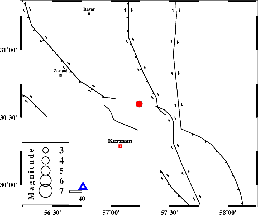
| Location | Lat:30.6 Lon: 57.24 |
| Region | Kerman Province, 38 km North-East of Kerman |
Nearest Cities |
|
| 11 km North of Dehlulu, Kerman Province | |
| 12 km East of Harjand, Kerman Province | |
| 29 km North East of Hutak, Kerman Province | |
| 31 km South East of Hejdak, Kerman Province | |
| 32 km East of Chatrud, Kerman Province | |
| Depth | 14 km |
| Agency | |
Faults within 150 km: |
|
| LAKARKUH_F (Length: 138 km) , Distance to epicenter: 15 km | |
| GOLBAF_SIRCH_F (Length: 114 km) , Distance to epicenter: 15 km | |
| KUHBANAN_F (Length: 189 km) , Distance to epicenter: 20 km | |
| Number of Phases | 6 |
| RMS | 0 |
| Number of Stations | 5 |
| Error in Latitude | >1.1 km |
| Error in Longitude | 2.4 km |
| Error in Depth | 3 km |
Download waveform in seisan format
to download seisan software Click here
to access information about IIEES stations Click here
Amplitude | ||||||||
| UID | Agency | Station | Component | Amplitude | Period | Arrival Time | Proccessing Time | Signal Clip |
| 90344 | IIEES | YZKH | E | 328.1 | 0.52 | 2013-08-25 12:57:10 | 2013-08-25 02:40:00 | n |
| 90345 | IIEES | YZKH | N | 266.9 | 0.52 | 2013-08-25 12:57:19 | 2013-08-25 02:40:00 | n |
| 90346 | IIEES | TABS | N | 303.4 | 0.56 | 2013-08-25 12:57:22 | 2013-08-25 02:40:00 | n |
| 90347 | IIEES | TABS | E | 135.8 | 0.64 | 2013-08-25 12:57:24 | 2013-08-25 02:40:00 | n |
Phase | ||||||||||||
| Agency | Station | Component | Phase Type | Phase Quality | First Motion | Observed Arrival Time | Time Residual | Loc. Flag | Input Weight | Distance | Azimuth | |
| IIEES | KRBR | Z | Pg | E | 2013-08-25 12:55:50 | -0.01 | y | 82.9 | 214 | |||
| IIEES | BSRN | Z | Pn | E | 2013-08-25 12:56:12 | -0.03 | y | 235 | 49 | |||
| IIEES | YZKH | Z | P | E | 2013-08-25 12:56:23 | 0.01 | y | 320 | 309 | |||
| IIEES | TABS | Z | Pn | E | 2013-08-25 12:56:25 | 0 | y | 338 | 358 | |||
| IIEES | TABS | E | Sg | E | 2013-08-25 12:57:10 | -0.01 | y | 338 | 358 | |||
| IIEES | SHRT | Z | Pn | E | 2013-08-25 12:56:38 | 0.06 | y | 444 | 40 | |||