
Magnitude |
3.1 |
| Date & Time (UTC) | 2013-09-11 04:03:11.2 |
| Date & Time (Local) | 1392/6/20 08:33:11.2 |
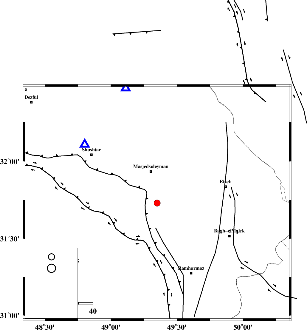
| Location | Lat:31.73 Lon: 49.35 |
| Region | Khoozestan Province, 23 km South of Masjed Soleyman |
Nearest Cities |
|
| 19 km North of Gazin, Khoozestan Province | |
| 23 km South of Masjed Soleyman, Khoozestan Province | |
| 27 km North West of Jaru, Khoozestan Province | |
| 36 km North West of Haftgol, Khoozestan Province | |
| 41 km West of Chenarestan, Khoozestan Province | |
| Depth | 14 km |
| Agency | |
Faults within 150 km: |
|
| DEZFUL_EMBAYMENT (Length: 228 km) , Distance to epicenter: 5 km | |
| MFF2 (Length: 205 km) , Distance to epicenter: 46 km | |
| AGHAJARI_F (Length: 88 km) , Distance to epicenter: 60 km | |
| Number of Phases | 8 |
| RMS | 0.1 |
| Number of Stations | 6 |
| Error in Latitude | >2.4 km |
| Error in Longitude | 9.5 km |
| Error in Depth | 6.6 km |
Download waveform in seisan format
to download seisan software Click here
to access information about IIEES stations Click here
Amplitude | ||||||||
| UID | Agency | Station | Component | Amplitude | Period | Arrival Time | Proccessing Time | Signal Clip |
| 90517 | IIEES | ASAO | E | 61.7 | 0.45 | 2013-09-11 04:04:49 | 2013-09-11 05:51:00 | n |
Phase | ||||||||||||
| Agency | Station | Component | Phase Type | Phase Quality | First Motion | Observed Arrival Time | Time Residual | Loc. Flag | Input Weight | Distance | Azimuth | |
| IIEES | KHMZ | Z | Pn | E | 2013-09-11 04:03:47 | 0.1 | y | 230 | 14 | |||
| IIEES | KHMZ | E | Sg | E | 2013-09-11 04:04:16 | -0.1 | y | 230 | 14 | |||
| IIEES | ASAO | Z | Pn | E | 2013-09-11 04:03:58 | 0.12 | y | 319 | 11 | |||
| IIEES | ASAO | E | Sg | E | 2013-09-11 04:04:40 | 0.04 | y | 319 | 11 | |||
| IIEES | GHVR | Z | Pn | E | 2013-09-11 04:04:02 | 0.13 | y | 353 | 30 | |||
| IIEES | AHRM | Z | Pn | E | 2013-09-11 04:04:04 | -0.06 | y | 368 | 149 | |||
| IIEES | CHTH | Z | Pn | E | 2013-09-11 04:04:19 | -0.19 | y | 492 | 19 | |||
| IIEES | ZNJK | Z | Pn | E | 2013-09-11 04:04:27 | -0.12 | y | 552 | 354 | |||