
Magnitude |
3.2 |
| Date & Time (UTC) | 2013-09-12 02:32:32.4 |
| Date & Time (Local) | 1392/6/21 07:02:32.4 |
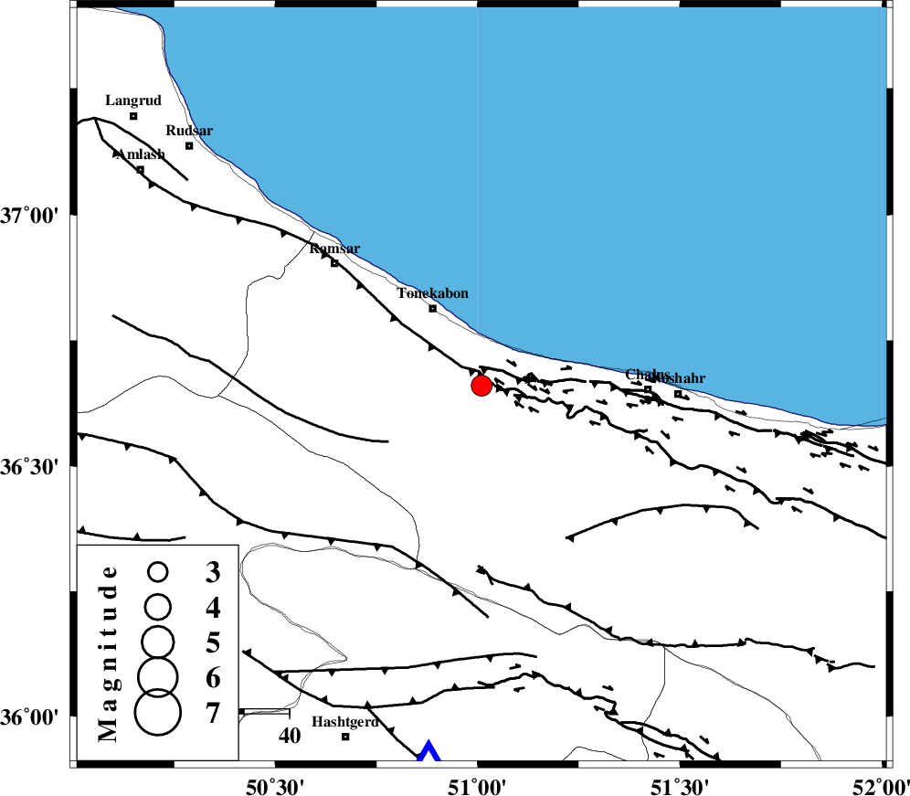
| Location | Lat:36.66 Lon: 51.01 |
| Region | Mazandaran Province, 20 km South-East of Tonekabon |
Nearest Cities |
|
| 8 km of Kanza, Mazandaran Province | |
| 11 km of Abbasabad, Mazandaran Province | |
| 18 km South East of Khorramabad, Mazandaran Province | |
| 18 km West of Tazehabad, Mazandaran Province | |
| 20 km South East of Tonekabon, Mazandaran Province | |
| Depth | 14 km |
| Agency | |
Faults within 150 km: |
|
| KHAZAR_F (Length: 523 km) , Distance to epicenter: 6 km | |
| N_ALBORZ_F (Length: 360 km) , Distance to epicenter: 6 km | |
| BONAN_F (Length: 74 km) , Distance to epicenter: 24 km | |
| Number of Phases | 5 |
| RMS | 0.2 |
| Number of Stations | 4 |
| Error in Latitude | >6.4 km |
| Error in Longitude | 6.4 km |
| Error in Depth | 8.7 km |
Download waveform in seisan format
to download seisan software Click here
to access information about IIEES stations Click here
Amplitude | ||||||||
| UID | Agency | Station | Component | Amplitude | Period | Arrival Time | Proccessing Time | Signal Clip |
| 90527 | IIEES | GHVR | E | 100.1 | 0.44 | 2013-09-12 02:33:50 | 2013-09-12 04:11:00 | n |
| 90528 | IIEES | KHMZ | N | 74.4 | 0.52 | 2013-09-12 02:33:36 | 2013-09-12 04:11:00 | n |
| 90529 | IIEES | KHMZ | E | 75.5 | 0.6 | 2013-09-12 02:33:37 | 2013-09-12 04:11:00 | n |
Phase | ||||||||||||
| Agency | Station | Component | Phase Type | Phase Quality | First Motion | Observed Arrival Time | Time Residual | Loc. Flag | Input Weight | Distance | Azimuth | |
| IIEES | CHTH | N | Pg | E | 2013-09-12 02:32:46 | -0.2 | y | 84.5 | 173 | |||
| IIEES | CHTH | E | Sg | E | 2013-09-12 02:32:57 | -0.02 | y | 84.5 | 173 | |||
| IIEES | GHVR | Z | Pn | E | 2013-09-12 02:33:10 | 0.32 | y | 243 | 175 | |||
| IIEES | ASAO | Z | Pn | E | 2013-09-12 02:33:11 | -0.16 | y | 251 | 201 | |||
| IIEES | ASAO | E | Sg | E | 2013-09-12 02:33:43 | 0.06 | y | 251 | 201 | |||