
Magnitude |
3 |
| Date & Time (UTC) | 2013-09-12 17:21:54.9 |
| Date & Time (Local) | 1392/6/21 21:51:54.9 |
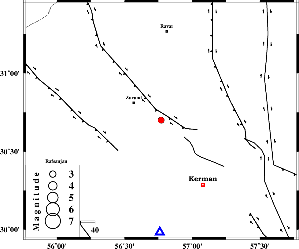
| Location | Lat:30.7 Lon: 56.77 |
| Region | Kerman Province, 22 km South-East of Zarand |
Nearest Cities |
|
| 3 km of Khankuk, Kerman Province | |
| 13 km East of Bahaabad, Kerman Province | |
| 16 km South of Hatkan, Kerman Province | |
| 17 km North of Kazemabad, Kerman Province | |
| 17 km North West of Chatrud, Kerman Province | |
| Depth | 14 km |
| Agency | |
Faults within 150 km: |
|
| KUHBANAN_F (Length: 189 km) , Distance to epicenter: 5 km | |
| CHATRUD_F (Length: 37 km) , Distance to epicenter: 20 km | |
| DARIVAN_F (Length: 131 km) , Distance to epicenter: 37 km | |
| Number of Phases | 6 |
| RMS | 0.4 |
| Number of Stations | 4 |
| Error in Latitude | >2.4 km |
| Error in Longitude | 7.9 km |
| Error in Depth | 8.7 km |
Download waveform in seisan format
to download seisan software Click here
to access information about IIEES stations Click here
Amplitude | ||||||||
| UID | Agency | Station | Component | Amplitude | Period | Arrival Time | Proccessing Time | Signal Clip |
| 90535 | IIEES | KRBR | E | 474.9 | 0.2 | 2013-09-12 17:22:23 | 2013-09-12 06:50:00 | n |
| 90536 | IIEES | YZKH | N | 70.8 | 0.44 | 2013-09-12 17:23:18 | 2013-09-12 06:50:00 | n |
| 90537 | IIEES | YZKH | E | 100.6 | 0.4 | 2013-09-12 17:23:19 | 2013-09-12 06:50:00 | n |
| 90538 | IIEES | TABS | N | 65.8 | 0.48 | 2013-09-12 17:23:38 | 2013-09-12 06:50:00 | n |
Phase | ||||||||||||
| Agency | Station | Component | Phase Type | Phase Quality | First Motion | Observed Arrival Time | Time Residual | Loc. Flag | Input Weight | Distance | Azimuth | |
| IIEES | KRBR | Z | P | E | 2013-09-12 17:22:08 | -0.46 | y | 80 | 180 | |||
| IIEES | KRBR | N | Sg | E | 2013-09-12 17:22:19 | 0.07 | y | 80 | 180 | |||
| IIEES | BSRN | Z | Pn | E | 2013-09-12 17:22:36 | 0.44 | y | 265 | 57 | |||
| IIEES | YZKH | Z | Pn | E | 2013-09-12 17:22:37 | 0.39 | y | 278 | 313 | |||
| IIEES | TABS | Z | Pn | E | 2013-09-12 17:22:43 | 0.01 | y | 328 | 6 | |||
| IIEES | TABS | E | Sg | E | 2013-09-12 17:23:26 | -0.48 | y | 328 | 6 | |||