
Magnitude |
3.1 |
| Date & Time (UTC) | 2013-09-15 05:25:05.6 |
| Date & Time (Local) | 1392/6/24 09:55:05.6 |
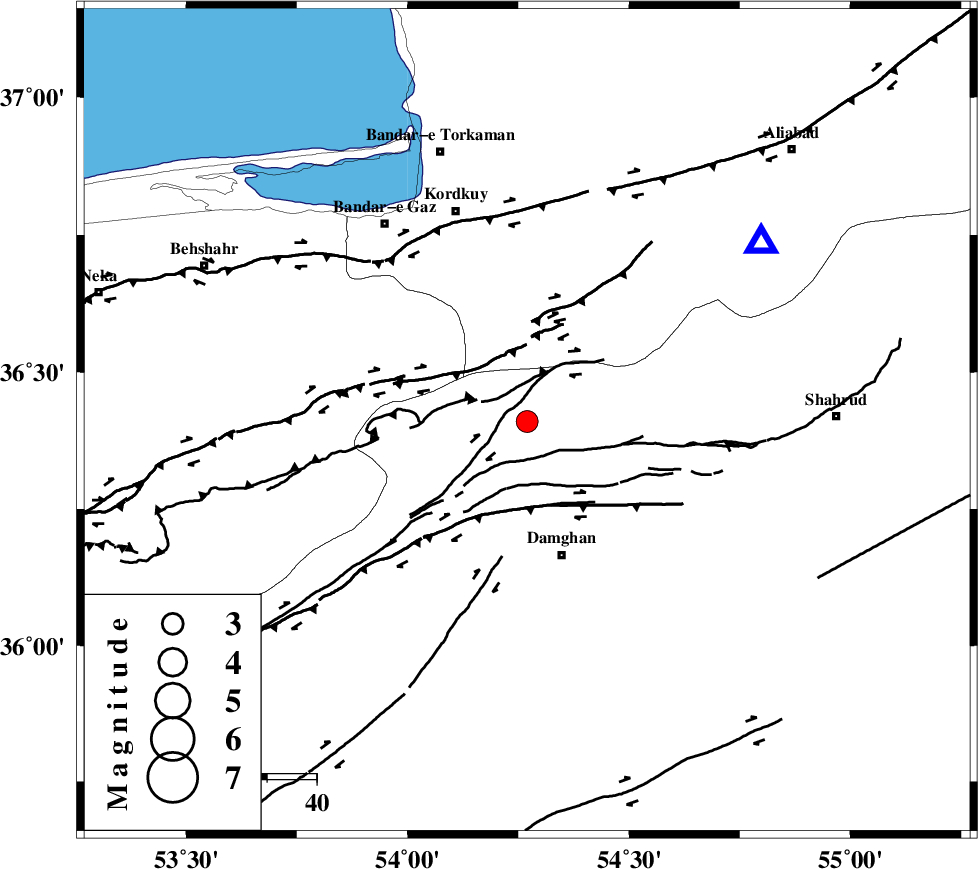
| Location | Lat:36.41 Lon: 54.27 |
| Region | Semnan Province, 28 km North of Damghan |
Nearest Cities |
|
| 23 km South West of Cheharbagh, Golestan Province | |
| 28 km North of Damghan, Semnan Province | |
| 32 km South West of Naharkhoran, Golestan Province | |
| 33 km North West of Mehmandust, Semnan Province | |
| 35 km West of Majen, Semnan Province | |
| Depth | 14 km |
| Agency | |
Faults within 150 km: |
|
| ASTANEH_F (Length: 72 km) , Distance to epicenter: 10 km | |
| N_ALBORZ_F (Length: 360 km) , Distance to epicenter: 16 km | |
| DAMGHAN_F (Length: 95 km) , Distance to epicenter: 21 km | |
| Number of Phases | 10 |
| RMS | 0.4 |
| Number of Stations | 9 |
| Error in Latitude | >6.2 km |
| Error in Longitude | 5 km |
| Error in Depth | 9.3 km |
Download waveform in seisan format
to download seisan software Click here
to access information about IIEES stations Click here
Amplitude | ||||||||
| UID | Agency | Station | Component | Amplitude | Period | Arrival Time | Proccessing Time | Signal Clip |
| 90546 | IIEES | DAMV | E | 119.5 | 0.42 | 2013-09-15 05:26:16 | 2013-09-15 09:03:00 | n |
| 90547 | IIEES | GHVR | E | 52.7 | 0.3 | 2013-09-15 05:26:48 | 2013-09-15 09:03:00 | n |
Phase | ||||||||||||
| Agency | Station | Component | Phase Type | Phase Quality | First Motion | Observed Arrival Time | Time Residual | Loc. Flag | Input Weight | Distance | Azimuth | |
| IIEES | MRVT | Z | Pg | E | 2013-09-15 05:25:39 | -0.7 | y | 213 | 49 | |||
| IIEES | MRVT | N | Sg | E | 2013-09-15 05:26:06 | 0.24 | y | 213 | 49 | |||
| IIEES | DAMV | Z | Pg | E | 2013-09-15 05:25:42 | -0.12 | y | 225 | 248 | |||
| IIEES | BJRD | Z | Pn | E | 2013-09-15 05:25:52 | 0.48 | y | 313 | 62 | |||
| IIEES | GHVR | Z | Pn | E | 2013-09-15 05:25:56 | 0.33 | y | 348 | 233 | |||
| IIEES | TABS | Z | Pn | E | 2013-09-15 05:26:03 | 0.15 | y | 402 | 139 | |||
| IIEES | ASAO | Z | Pn | E | 2013-09-15 05:26:08 | 0.29 | y | 437 | 243 | |||
| IIEES | YZKH | Z | Pn | E | 2013-09-15 05:26:08 | -0.19 | y | 447 | 176 | |||
| IIEES | KHMZ | Z | Pn | E | 2013-09-15 05:26:14 | -0.31 | y | 492 | 234 | |||
| IIEES | BSRN | Z | Pn | E | 2013-09-15 05:26:35 | -0.23 | y | 666 | 136 | |||