
Magnitude |
2.3 |
| Date & Time (UTC) | 2013-09-16 03:58:09.7 |
| Date & Time (Local) | 1392/6/25 08:28:09.7 |
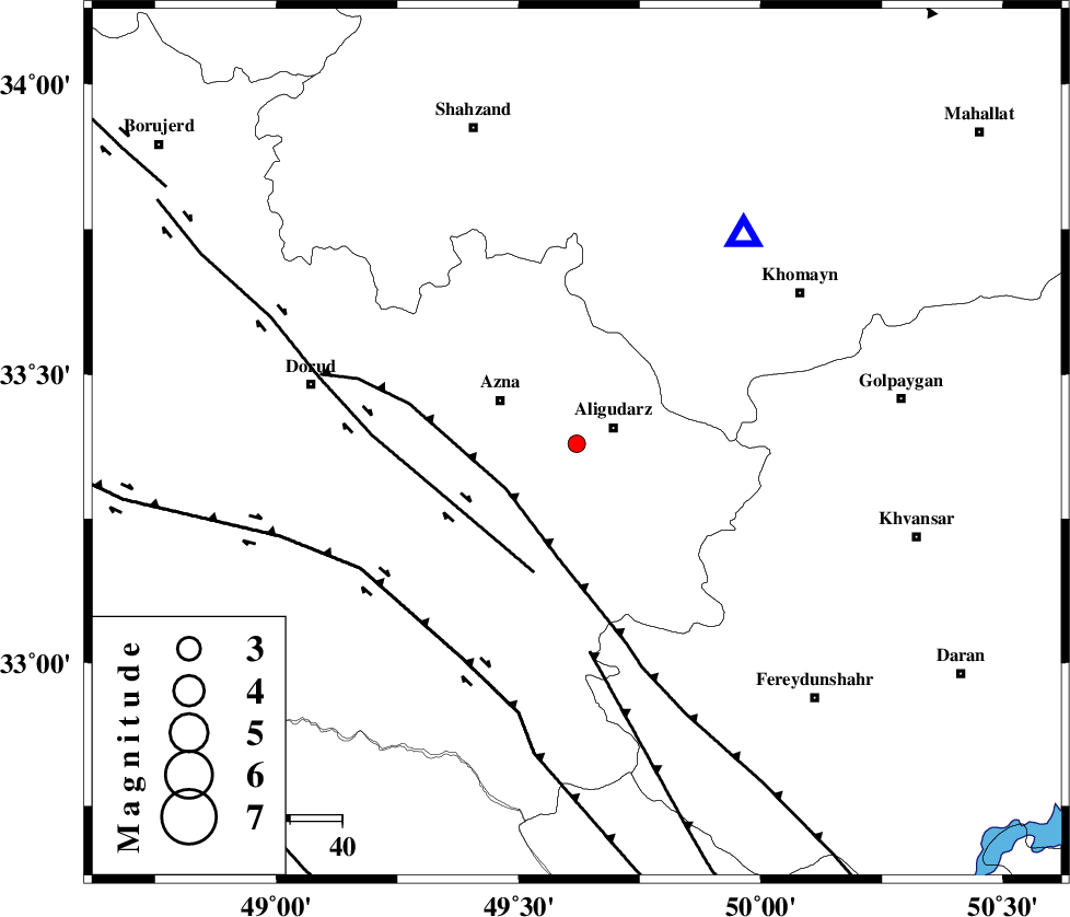
| Location | Lat:33.38 Lon: 49.62 |
| Region | Lorestan Province, 7 km Aligudarz |
Nearest Cities |
|
| 3 km of Sur, Lorestan Province | |
| 8 km of Aligudarz, Lorestan Province | |
| 13 km of Khameh sofla, Lorestan Province | |
| 16 km North of Shapoorabad, Lorestan Province | |
| 16 km North of Shapoorabad, Lorestan Province | |
| Depth | 14 km |
| Agency | |
Faults within 150 km: |
|
| MAIN_ZAGROS_R_F (Length: 1106 km) , Distance to epicenter: 16 km | |
| DORUD (Length: 100 km) , Distance to epicenter: 26 km | |
| ARDAL_F (Length: 170 km) , Distance to epicenter: 40 km | |
| Number of Phases | 7 |
| RMS | 0.1 |
| Number of Stations | 6 |
| Error in Latitude | >1.6 km |
| Error in Longitude | 2.7 km |
| Error in Depth | 4 km |
Download waveform in seisan format
to download seisan software Click here
to access information about IIEES stations Click here
Amplitude | ||||||||
| UID | Agency | Station | Component | Amplitude | Period | Arrival Time | Proccessing Time | Signal Clip |
| 90550 | IIEES | GHVR | E | 32.2 | 0.6 | 2013-09-16 03:59:13 | 2013-09-16 05:24:00 | n |
Phase | ||||||||||||
| Agency | Station | Component | Phase Type | Phase Quality | First Motion | Observed Arrival Time | Time Residual | Loc. Flag | Input Weight | Distance | Azimuth | |
| IIEES | KHMZ | Z | Pg | E | 2013-09-16 03:58:18 | -0.17 | y | 50.7 | 39 | |||
| IIEES | ASAO | Z | Pg | E | 2013-09-16 03:58:32 | 0.07 | y | 134 | 16 | |||
| IIEES | SHGR | Z | Pg | E | 2013-09-16 03:58:36 | -0.21 | y | 161 | 209 | |||
| IIEES | SHGR | N | Sg | E | 2013-09-16 03:58:55 | 0.15 | y | 161 | 209 | |||
| IIEES | GHVR | Z | Pg | E | 2013-09-16 03:58:41 | 0.15 | y | 193 | 51 | |||
| IIEES | SNGE | Z | Pn | E | 2013-09-16 03:58:52 | 0.01 | y | 283 | 313 | |||
| IIEES | YZKH | Z | Pn | E | 2013-09-16 03:59:17 | 0.01 | y | 478 | 102 | |||