
Magnitude |
3.4 |
| Date & Time (UTC) | 2013-09-22 23:58:39.1 |
| Date & Time (Local) | 1392/7/1 03:28:39.1 |
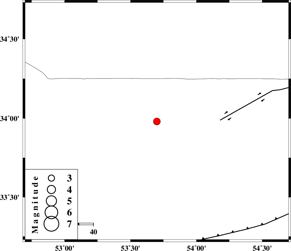
| Location | Lat:33.98 Lon: 53.7 |
| Region | Esfahan Province, 136 km North-East of Nain |
Nearest Cities |
|
| 49 km North East of Maedan, Esfahan Province | |
| 66 km West of Jondaq, Esfahan Province | |
| 74 km North West of Chupanan, Esfahan Province | |
| 74 km North of Anarak, Esfahan Province | |
| 109 km North East of Shahrab, Esfahan Province | |
| Depth | 16 km |
| Agency | |
Faults within 150 km: |
|
| DORUNEH_F (Length: 713 km) , Distance to epicenter: 44 km | |
| BIABANAK_F (Length: 162 km) , Distance to epicenter: 88 km | |
| CHAH_ZANGUL_F (Length: 123 km) , Distance to epicenter: 107 km | |
| Number of Phases | 6 |
| RMS | 0 |
| Number of Stations | 4 |
| Error in Latitude | >2.4 km |
| Error in Longitude | 2.3 km |
| Error in Depth | 4.1 km |
Download waveform in seisan format
to download seisan software Click here
to access information about IIEES stations Click here
Amplitude | ||||||||
| UID | Agency | Station | Component | Amplitude | Period | Arrival Time | Proccessing Time | Signal Clip |
| 90605 | IIEES | GHVR | E | 255.2 | 0.32 | 2013-09-22 23:59:53 | 2013-09-23 01:55:00 | n |
Phase | ||||||||||||
| Agency | Station | Component | Phase Type | Phase Quality | First Motion | Observed Arrival Time | Time Residual | Loc. Flag | Input Weight | Distance | Azimuth | |
| IIEES | YZKH | Z | Pn | E | 2013-09-22 23:59:10 | -0.04 | y | 195 | 155 | |||
| IIEES | YZKH | N | Sg | E | 2013-09-22 23:59:34 | 0.03 | y | 195 | 155 | |||
| IIEES | GHVR | Z | Pn | E | 2013-09-22 23:59:15 | 0.02 | y | 233 | 284 | |||
| IIEES | GHVR | N | Sg | E | 2013-09-22 23:59:44 | -0.03 | y | 233 | 284 | |||
| IIEES | DAMV | Z | Pn | E | 2013-09-22 23:59:16 | 0.04 | y | 242 | 320 | |||
| IIEES | TABS | Z | Pn | E | 2013-09-22 23:59:26 | -0.03 | y | 319 | 96 | |||