
Magnitude |
3.3 |
| Date & Time (UTC) | 2013-09-24 06:14:25.2 |
| Date & Time (Local) | 1392/7/2 09:44:25.2 |
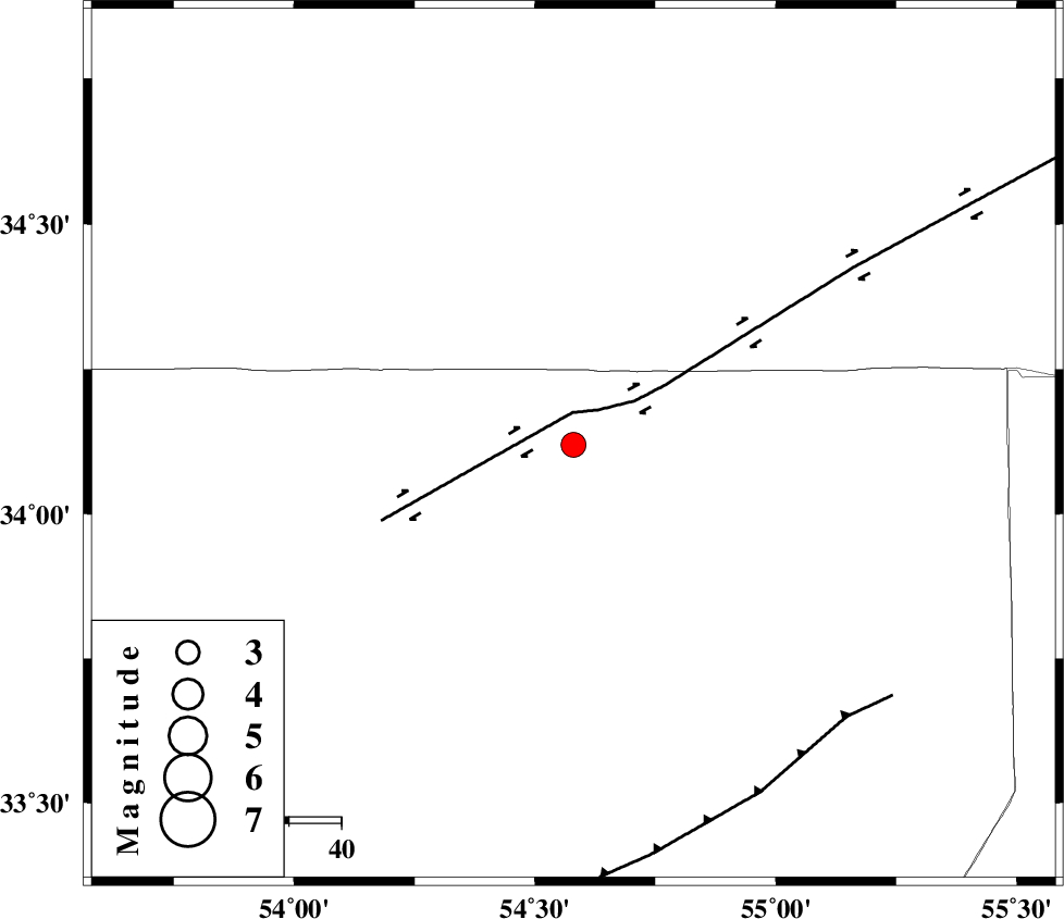
| Location | Lat:34.12 Lon: 54.58 |
| Region | Esfahan Province, 229 km South-East of Damghan |
Nearest Cities |
|
| 17 km North East of Jondaq, Esfahan Province | |
| 45 km North West of Farrokhi, Esfahan Province | |
| 59 km North East of Chupanan, Esfahan Province | |
| 60 km North West of Khur, Esfahan Province | |
| 87 km North West of Mehranjan, Esfahan Province | |
| Depth | 15 km |
| Agency | |
Faults within 150 km: |
|
| DORUNEH_F (Length: 713 km) , Distance to epicenter: 6 km | |
| BIABANAK_F (Length: 162 km) , Distance to epicenter: 74 km | |
| TORUD_F (Length: 136 km) , Distance to epicenter: 127 km | |
| Number of Phases | 10 |
| RMS | 0.7 |
| Number of Stations | 10 |
| Error in Latitude | >6.3 km |
| Error in Longitude | 4 km |
| Error in Depth | 0 km |
Download waveform in seisan format
to download seisan software Click here
to access information about IIEES stations Click here
Amplitude | ||||||||
| UID | Agency | Station | Component | Amplitude | Period | Arrival Time | Proccessing Time | Signal Clip |
| 90621 | IIEES | KRBR | E | 27.9 | 0.69 | 2013-09-24 06:17:06 | 2013-09-24 07:51:00 | n |
Phase | ||||||||||||
| Agency | Station | Component | Phase Type | Phase Quality | First Motion | Observed Arrival Time | Time Residual | Loc. Flag | Input Weight | Distance | Azimuth | |
| IIEES | YZKH | Z | Pn | E | 2013-09-24 06:14:55 | -0.79 | y | 191 | 180 | |||
| IIEES | TABS | Z | Pn | E | 2013-09-24 06:15:02 | -0.09 | y | 241 | 102 | |||
| IIEES | GHVR | Z | Pn | E | 2013-09-24 06:15:11 | -0.16 | y | 309 | 278 | |||
| IIEES | CHTH | Z | Pn | E | 2013-09-24 06:15:19 | -0.16 | y | 373 | 303 | |||
| IIEES | MRVT | Z | Pn | E | 2013-09-24 06:15:24 | 0.05 | y | 416 | 19 | |||
| IIEES | ASAO | Z | Pn | E | 2013-09-24 06:15:25 | 0.34 | y | 422 | 278 | |||
| IIEES | BJRD | Z | Pn | E | 2013-09-24 06:15:31 | 0.28 | y | 473 | 32 | |||
| IIEES | BSRN | Z | Pn | E | 2013-09-24 06:15:32 | -0.65 | y | 487 | 118 | |||
| IIEES | KRBR | Z | Pn | E | 2013-09-24 06:15:37 | 2 | y | 502 | 155 | |||
| IIEES | SHRT | Z | Pn | E | 2013-09-24 06:15:38 | -0.28 | y | 531 | 94 | |||