
Magnitude |
2.8 |
| Date & Time (UTC) | 2013-10-01 00:21:38.7 |
| Date & Time (Local) | 1392/7/9 03:51:38.7 |
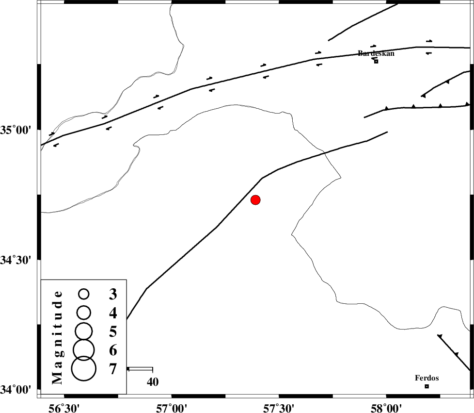
| Location | Lat:34.73 Lon: 57.39 |
| Region | Yazd Province, 78 km South-West of Bardeskan |
Nearest Cities |
|
| 24 km South East of Tappeh taq, Yazd Province | |
| 59 km North East of Eshqabad, Yazd Province | |
| 67 km South West of Shahrabad, Khorasan(center) Province | |
| 73 km North West of Mazar, Khorasan(center) Province | |
| 76 km North West of Bajestan, Khorasan(center) Province | |
| Depth | 14 km |
| Agency | |
Faults within 150 km: |
|
| NAINI_F (Length: 342 km) , Distance to epicenter: 10 km | |
| DORUNEH_F (Length: 713 km) , Distance to epicenter: 55 km | |
| MEHDIABAD_F (Length: 64 km) , Distance to epicenter: 58 km | |
| Number of Phases | 5 |
| RMS | 0.1 |
| Number of Stations | 4 |
| Error in Latitude | >4.8 km |
| Error in Longitude | 3.8 km |
| Error in Depth | 7.2 km |
Download waveform in seisan format
to download seisan software Click here
to access information about IIEES stations Click here
Amplitude | ||||||||
| UID | Agency | Station | Component | Amplitude | Period | Arrival Time | Proccessing Time | Signal Clip |
| 90654 | IIEES | TABS | N | 195 | 0.44 | 2013-10-01 00:22:20 | 2013-10-01 02:29:00 | n |
| 90655 | IIEES | SHRT | N | 38.9 | 0.36 | 2013-10-01 00:23:04 | 2013-10-01 02:29:00 | n |
| 90656 | IIEES | SHRT | E | 47.2 | 0.36 | 2013-10-01 00:23:06 | 2013-10-01 02:29:00 | n |
Phase | ||||||||||||
| Agency | Station | Component | Phase Type | Phase Quality | First Motion | Observed Arrival Time | Time Residual | Loc. Flag | Input Weight | Distance | Azimuth | |
| IIEES | TABS | Z | Pg | E | 2013-10-01 00:21:59 | -0.14 | y | 123 | 192 | |||
| IIEES | TABS | E | Sg | E | 2013-10-01 00:22:14 | 0.09 | y | 123 | 192 | |||
| IIEES | SHRT | Z | P | E | 2013-10-01 00:22:22 | 0.12 | y | 293 | 113 | |||
| IIEES | BSRN | Z | P | E | 2013-10-01 00:22:29 | -0.14 | y | 347 | 152 | |||
| IIEES | YZKH | Z | P | E | 2013-10-01 00:22:32 | 0.07 | y | 368 | 226 | |||