
Magnitude |
2.7 |
| Date & Time (UTC) | 2013-10-05 16:43:23.7 |
| Date & Time (Local) | 1392/7/13 20:13:23.7 |
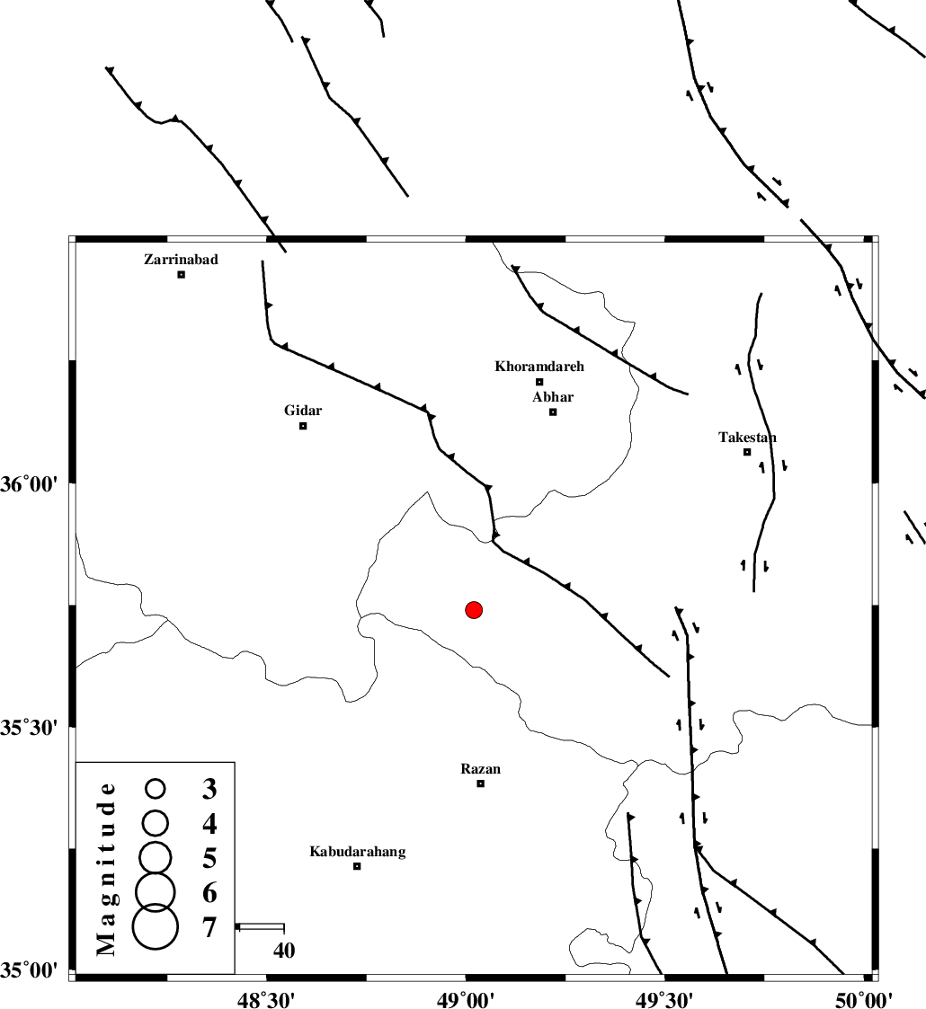
| Location | Lat:35.74 Lon: 49.02 |
| Region | Ghazvin Province, 39 km North of Razan |
Nearest Cities |
|
| 24 km West of Ab-e garm, Ghazvin Province | |
| 26 km North West of Avaj, Ghazvin Province | |
| 32 km North East of Kahla, Zanjan Province | |
| 32 km North East of Khorandeh, Hamedan Province | |
| 36 km West of Hoseynabad, Ghazvin Province | |
| Depth | 14 km |
| Agency | |
Faults within 150 km: |
|
| KUSHK_E_NOSRAT_F (Length: 230 km) , Distance to epicenter: 10 km | |
| SOLTANIYEH_F (Length: 119 km) , Distance to epicenter: 31 km | |
| ZANJAN_F (Length: 137 km) , Distance to epicenter: 54 km | |
| Number of Phases | 4 |
| RMS | 0 |
| Number of Stations | 5 |
| Error in Latitude | >2.3 km |
| Error in Longitude | 3.9 km |
| Error in Depth | 4.4 km |
Download waveform in seisan format
to download seisan software Click here
to access information about IIEES stations Click here
Amplitude | ||||||||
| UID | Agency | Station | Component | Amplitude | Period | Arrival Time | Proccessing Time | Signal Clip |
| 90715 | IIEES | CHTH | N | 49.6 | 0.32 | 2013-10-05 16:44:22 | 2013-10-05 06:06:00 | n |
| 90716 | IIEES | GHVR | E | 31.6 | 0.48 | 2013-10-05 16:44:45 | 2013-10-05 06:06:00 | n |
| 90717 | IIEES | GHVR | N | 32.1 | 0.52 | 2013-10-05 16:44:46 | 2013-10-05 06:06:00 | n |
| 90718 | IIEES | BSRN | E | 1.4 | 0.08 | 2013-10-05 16:46:38 | 2013-10-05 06:06:00 | n |
Phase | ||||||||||||
| Agency | Station | Component | Phase Type | Phase Quality | First Motion | Observed Arrival Time | Time Residual | Loc. Flag | Input Weight | Distance | Azimuth | |
| IIEES | ZNJK | Z | Pg | E | 2013-10-05 16:43:42 | 0 | y | 108 | 344 | |||
| IIEES | ASAO | Z | Pg | E | 2013-10-05 16:43:50 | -0.05 | y | 161 | 145 | |||
| IIEES | CHTH | Z | Pg | E | 2013-10-05 16:43:55 | -0.02 | y | 191 | 84 | |||
| IIEES | GHVR | Z | Pn | E | 2013-10-05 16:44:02 | 0.08 | y | 246 | 124 | |||