
Magnitude |
4.2 |
| Date & Time (UTC) | 2013-10-14 20:33:21.0 |
| Date & Time (Local) | 1392/7/23 00:03:21.0 |
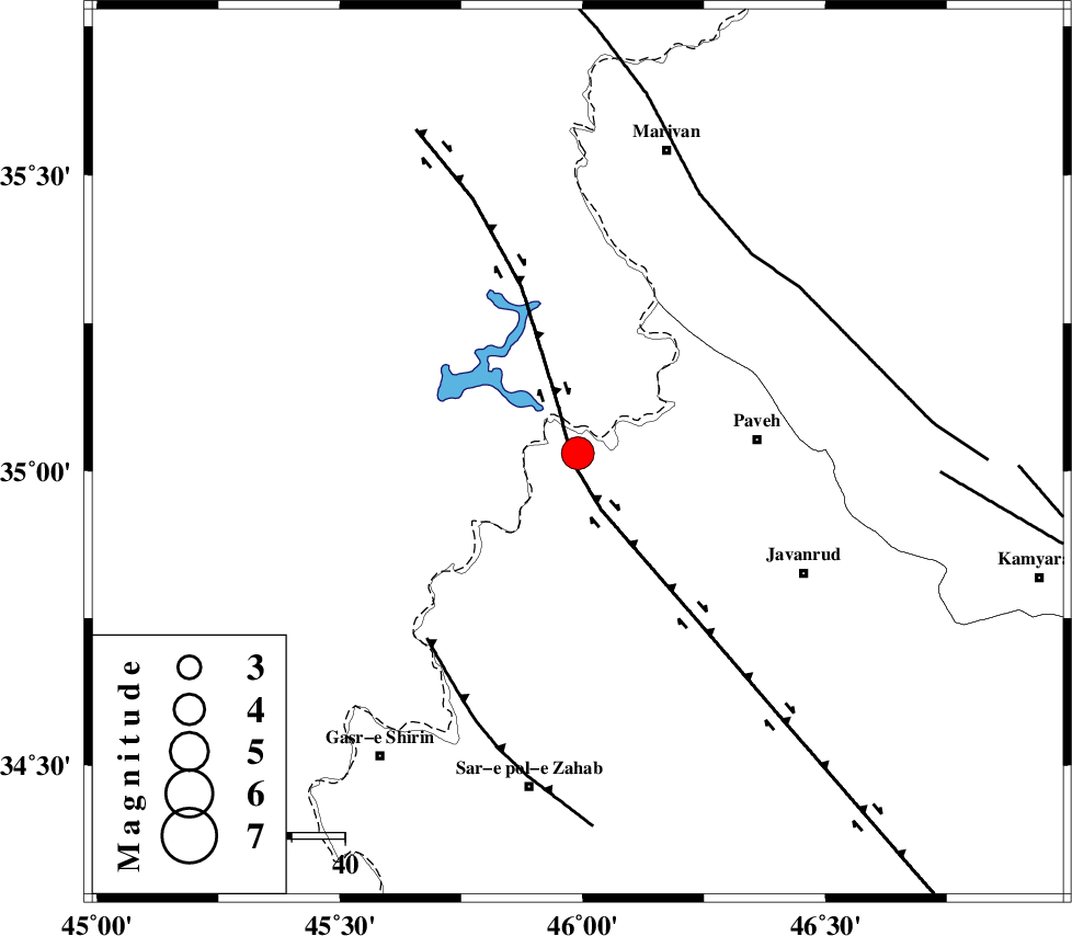
| Location | Lat:35.03 Lon: 45.99 |
| Region | Kermanshah Province, 34 km West of Paveh |
Nearest Cities |
|
| 6 km of Markhil, Kermanshah Province | |
| 14 km North West of Bayangan, Kermanshah Province | |
| 17 km North West of Mazran, Kermanshah Province | |
| 18 km North West of Dudan, Kermanshah Province | |
| 18 km North West of Dudan, Kermanshah Province | |
| Depth | 15 km |
| Agency | |
Faults within 150 km: |
|
| HZF4 (Length: 492 km) , Distance to epicenter: 2 km | |
| MFF8 (Length: 48 km) , Distance to epicenter: 45 km | |
| PIRANSHAHR_F (Length: 253 km) , Distance to epicenter: 50 km | |
| Number of Phases | 6 |
| RMS | 0.2 |
| Number of Stations | 7 |
| Error in Latitude | >6 km |
| Error in Longitude | 2.1 km |
| Error in Depth | 0 km |
Download waveform in seisan format
to download seisan software Click here
to access information about IIEES stations Click here
Amplitude | ||||||||
| UID | Agency | Station | Component | Amplitude | Period | Arrival Time | Proccessing Time | Signal Clip |
| 90786 | IIEES | ASAO | E | 231.3 | 0.52 | 2013-10-14 20:35:15 | 2013-10-14 10:07:00 | n |
| 90787 | IIEES | GHVR | N | 87.2 | 0.6 | 2013-10-14 20:35:53 | 2013-10-14 10:07:00 | n |
| 90788 | IIEES | AHRM | E | 74.6 | 0.48 | 2013-10-14 20:36:37 | 2013-10-14 10:07:00 | n |
| 90789 | IIEES | AHRM | N | 77 | 0.52 | 2013-10-14 20:36:38 | 2013-10-14 10:07:00 | n |
Phase | ||||||||||||
| Agency | Station | Component | Phase Type | Phase Quality | First Motion | Observed Arrival Time | Time Residual | Loc. Flag | Input Weight | Distance | Azimuth | |
| IIEES | ZNJK | Z | Pn | E | 2013-10-14 20:34:06 | 0.05 | y | 304 | 52 | |||
| IIEES | ASAO | Z | Pn | E | 2013-10-14 20:34:15 | 0.08 | y | 374 | 97 | |||
| IIEES | GRMI | Z | Pn | E | 2013-10-14 20:34:24 | -0.19 | y | 453 | 22 | |||
| IIEES | CHTH | Z | Pn | E | 2013-10-14 20:34:28 | 0.21 | y | 477 | 77 | |||
| IIEES | GHVR | Z | Pn | E | 2013-10-14 20:34:28 | -0.26 | y | 485 | 96 | |||
| IIEES | MAKU | Z | Pn | E | 2013-10-14 20:34:30 | 0.09 | y | 494 | 347 | |||