
Magnitude |
3.3 |
| Date & Time (UTC) | 2013-10-21 23:28:38.2 |
| Date & Time (Local) | 1392/7/30 02:58:38.2 |
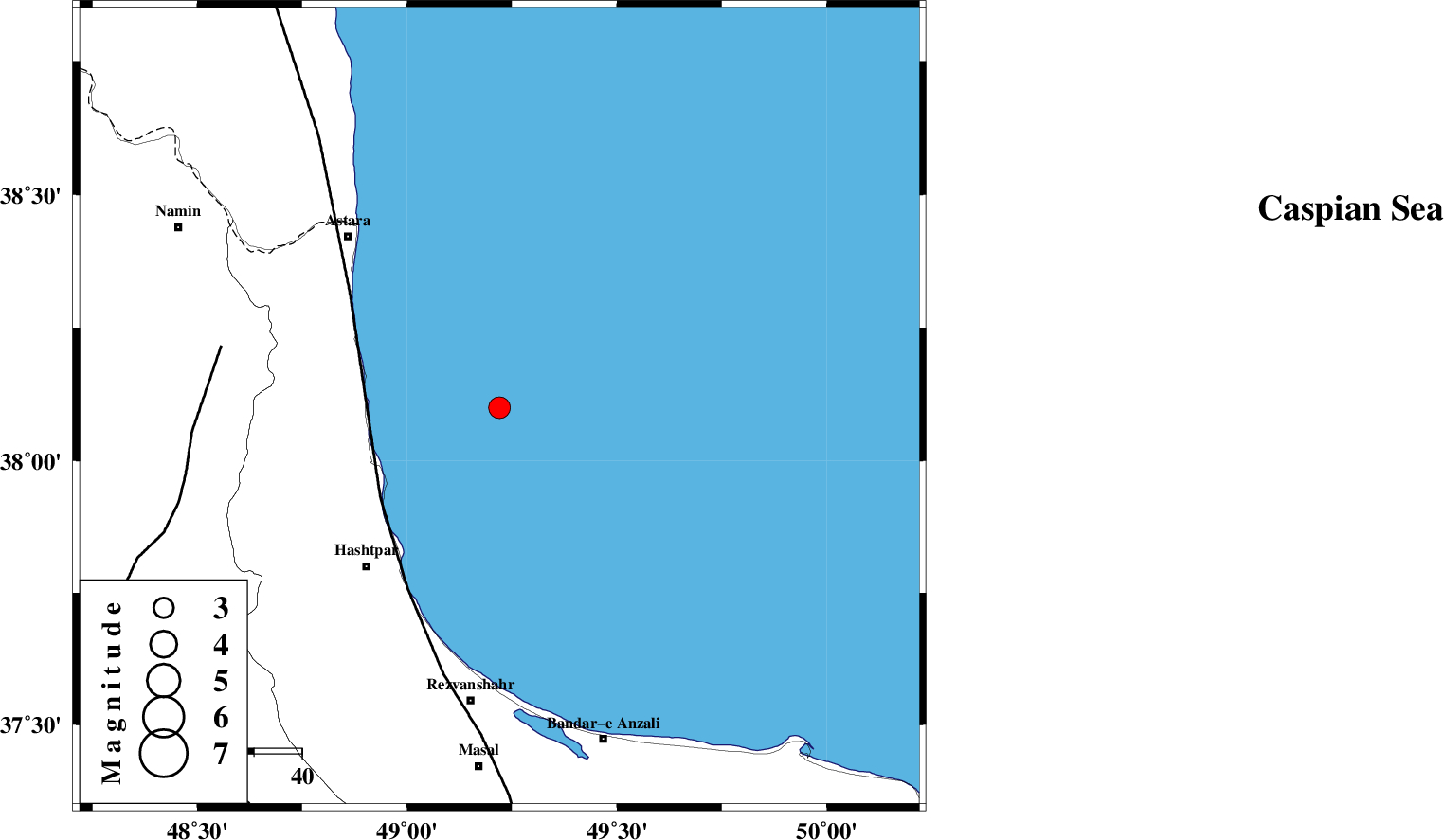
| Location | Lat:38.1 Lon: 49.22 |
| Region | Caspian Sea, 44 km North-East of Hashtpar |
Nearest Cities |
|
| 29 km North East of Lisar, Gilan Province | |
| 31 km East of Hariq, Gilan Province | |
| 38 km North East of Chelonasr, Gilan Province | |
| 40 km South East of Londovil, Gilan Province | |
| 43 km North East of Hashtpar, Gilan Province | |
| Depth | 15 km |
| Agency | |
Faults within 150 km: |
|
| TALESH_F (Length: 258 km) , Distance to epicenter: 31 km | |
| SANGAVAR_F (Length: 61 km) , Distance to epicenter: 59 km | |
| BOZQUSH (Length: 70 km) , Distance to epicenter: 90 km | |
| Number of Phases | 3 |
| RMS | 0 |
| Number of Stations | 3 |
| Error in Latitude | >2.3 km |
| Error in Longitude | 3.7 km |
| Error in Depth | 0 km |
Download waveform in seisan format
to download seisan software Click here
to access information about IIEES stations Click here
Amplitude | ||||||||
| UID | Agency | Station | Component | Amplitude | Period | Arrival Time | Proccessing Time | Signal Clip |
| 90841 | IIEES | GRMI | N | 626.8 | 0.51 | 2013-10-21 23:29:20 | 2013-10-22 12:52:00 | n |
| 90842 | IIEES | ZNJK | E | 313.6 | 0.24 | 2013-10-21 23:29:28 | 2013-10-22 12:52:00 | n |
Phase | ||||||||||||
| Agency | Station | Component | Phase Type | Phase Quality | First Motion | Observed Arrival Time | Time Residual | Loc. Flag | Input Weight | Distance | Azimuth | |
| IIEES | GRMI | Z | Pg | E | 2013-10-21 23:29:01 | 0 | y | 140 | 305 | |||
| IIEES | ZNJK | Z | Pg | E | 2013-10-21 23:29:05 | -0.01 | y | 166 | 197 | |||
| IIEES | CHTH | Z | Pn | E | 2013-10-21 23:29:22 | 0.01 | y | 297 | 145 | |||