
Magnitude |
3.6 |
| Date & Time (UTC) | 2013-10-22 11:09:40.7 |
| Date & Time (Local) | 1392/7/30 14:39:40.7 |
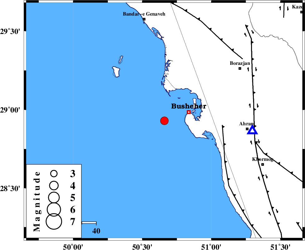
| Location | Lat:28.93 Lon: 50.66 |
| Region | Persian Gulf, 18 km West of Busheher |
Nearest Cities |
|
| 18 km West of Busheher, Bushehr Province | |
| 37 km West of Choghadak, Bushehr Province | |
| 44 km North West of Delvar, Bushehr Province | |
| 45 km South West of Kareband, Bushehr Province | |
| 50 km South West of Shabankareh, Bushehr Province | |
| Depth | 18 km |
| Agency | |
Faults within 150 km: |
|
| ZFF2 (Length: 84 km) , Distance to epicenter: 41 km | |
| BORAZJAN_F (Length: 168 km) , Distance to epicenter: 63 km | |
| MFF5 (Length: 74 km) , Distance to epicenter: 65 km | |
| Number of Phases | 6 |
| RMS | 0.1 |
| Number of Stations | 5 |
| Error in Latitude | >8.7 km |
| Error in Longitude | 5.6 km |
| Error in Depth | 6.5 km |
Download waveform in seisan format
to download seisan software Click here
to access information about IIEES stations Click here
Amplitude | ||||||||
| UID | Agency | Station | Component | Amplitude | Period | Arrival Time | Proccessing Time | Signal Clip |
| 90843 | IIEES | AHRM | E | 3495 | 0.36 | 2013-10-22 11:10:01 | 2013-10-22 12:57:00 | n |
Phase | ||||||||||||
| Agency | Station | Component | Phase Type | Phase Quality | First Motion | Observed Arrival Time | Time Residual | Loc. Flag | Input Weight | Distance | Azimuth | |
| IIEES | AHRM | Z | Pg | E | 2013-10-22 11:09:51 | -0.01 | y | 62.7 | 96 | |||
| IIEES | AHRM | N | Sg | E | 2013-10-22 11:09:59 | 0.04 | y | 62.7 | 96 | |||
| IIEES | KRBR | Z | Pn | E | 2013-10-22 11:11:03 | -0.07 | y | 603 | 77 | |||
| IIEES | GHVR | Z | Pn | E | 2013-10-22 11:11:04 | 0.03 | y | 618 | 5 | |||
| IIEES | BSRN | Z | Pn | E | 2013-10-22 11:11:37 | -0.21 | y | 880 | 65 | |||
| IIEES | ZHSF | Z | Pn | E | 2013-10-22 11:11:50 | 0.27 | y | 986 | 83 | |||