
Magnitude |
3.3 |
| Date & Time (UTC) | 2013-10-23 13:52:57.9 |
| Date & Time (Local) | 1392/8/1 17:22:57.9 |
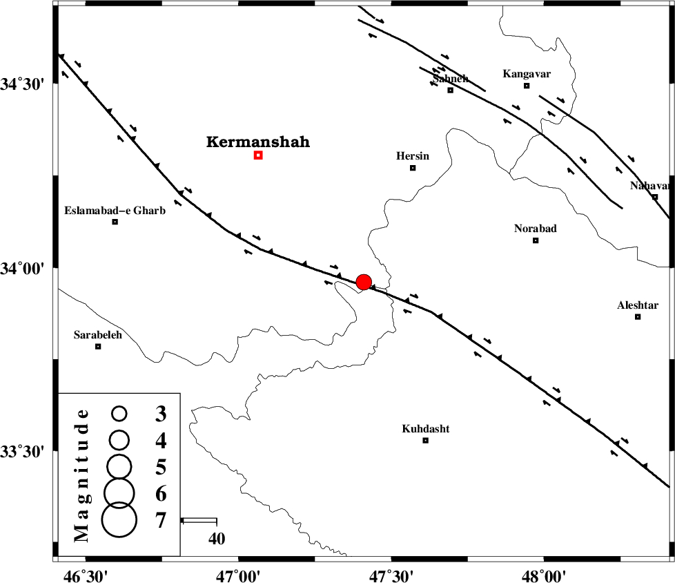
| Location | Lat:33.96 Lon: 47.41 |
| Region | Kermanshah Province, 38 km South-West of Harsin |
Nearest Cities |
|
| 24 km East of Buzhan, Kermanshah Province | |
| 26 km South of Cheshmeh kabud, Kermanshah Province | |
| 27 km North East of Chenar, Kermanshah Province | |
| 31 km South West of Kahrizvardasht-e olia, Lorestan Province | |
| 37 km South East of Kahrar-e muqufeh, Kermanshah Province | |
| Depth | 14 km |
| Agency | |
Faults within 150 km: |
|
| HZF4 (Length: 492 km) , Distance to epicenter: 7 km | |
| SAHANEH_F (Length: 77 km) , Distance to epicenter: 67 km | |
| DINEHVAR_F (Length: 46 km) , Distance to epicenter: 68 km | |
| Number of Phases | 7 |
| RMS | 0.1 |
| Number of Stations | 4 |
| Error in Latitude | >2.9 km |
| Error in Longitude | 2.9 km |
| Error in Depth | 3.6 km |
Download waveform in seisan format
to download seisan software Click here
to access information about IIEES stations Click here
Amplitude | ||||||||
| UID | Agency | Station | Component | Amplitude | Period | Arrival Time | Proccessing Time | Signal Clip |
| 90845 | IIEES | ASAO | E | 133.6 | 0.52 | 2013-10-23 13:54:14 | 2013-10-23 10:14:00 | n |
| 90846 | IIEES | ASAO | N | 171.8 | 0.76 | 2013-10-23 13:54:23 | 2013-10-23 10:14:00 | n |
| 90847 | IIEES | GHVR | N | 92.8 | 0.64 | 2013-10-23 13:54:51 | 2013-10-23 10:14:00 | n |
| 90848 | IIEES | GHVR | E | 78.1 | 0.56 | 2013-10-23 13:54:53 | 2013-10-23 10:14:00 | n |
Phase | ||||||||||||
| Agency | Station | Component | Phase Type | Phase Quality | First Motion | Observed Arrival Time | Time Residual | Loc. Flag | Input Weight | Distance | Azimuth | |
| IIEES | ASAO | Z | Pn | E | 2013-10-23 13:53:36 | 0.02 | y | 249 | 74 | |||
| IIEES | ASAO | N | Sg | E | 2013-10-23 13:54:08 | -0.07 | y | 249 | 74 | |||
| IIEES | ZNJK | Z | Pn | E | 2013-10-23 13:53:45 | -0.15 | y | 322 | 21 | |||
| IIEES | ZNJK | E | Sg | E | 2013-10-23 13:54:28 | 0.08 | y | 322 | 21 | |||
| IIEES | GHVR | Z | Pn | E | 2013-10-23 13:53:50 | 0.16 | y | 358 | 80 | |||
| IIEES | GHVR | E | Sn | 2013-10-23 13:54:28 | 0.01 | y | 358 | 80 | ||||
| IIEES | CHTH | Z | Pn | E | 2013-10-23 13:53:55 | -0.04 | y | 402 | 56 | |||