
Magnitude |
2.5 |
| Date & Time (UTC) | 2013-10-26 09:11:50.9 |
| Date & Time (Local) | 1392/8/4 12:41:50.9 |
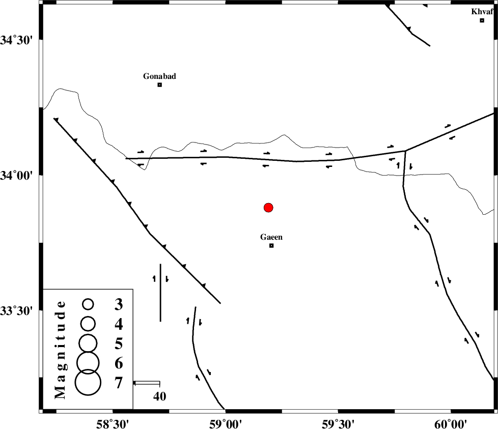
| Location | Lat:33.88 Lon: 59.19 |
| Region | 16 km North of Qaen |
Nearest Cities |
|
| 15 km East of Eslamabad, Khorasan(south) Province | |
| 16 km North of Qaen, Khorasan(south) Province | |
| 17 km North of Mahmuee, Khorasan(south) Province | |
| 33 km North East of Bihud, Khorasan(south) Province | |
| 39 km South East of Khazridasht-ebayaz, Khorasan(center) Province | |
| Depth | 35 km |
| Agency | |
Faults within 150 km: |
|
| DASHT_E_BAYAZ_F (Length: 177 km) , Distance to epicenter: 22 km | |
| FERDOWS_F (Length: 101 km) , Distance to epicenter: 44 km | |
| DUSTABAD_F (Length: 22 km) , Distance to epicenter: 50 km | |
| Number of Phases | 5 |
| RMS | 0.2 |
| Number of Stations | 3 |
| Error in Latitude | >2.5 km |
| Error in Longitude | 2 km |
| Error in Depth | 4.7 km |
Download waveform in seisan format
to download seisan software Click here
to access information about IIEES stations Click here
Amplitude | ||||||||
| UID | Agency | Station | Component | Amplitude | Period | Arrival Time | Proccessing Time | Signal Clip |
| 90855 | IIEES | SHRT | N | 115.1 | 0.35 | 2013-10-26 09:12:26 | 2013-10-26 10:51:00 | n |
Phase | ||||||||||||
| Agency | Station | Component | Phase Type | Phase Quality | First Motion | Observed Arrival Time | Time Residual | Loc. Flag | Input Weight | Distance | Azimuth | |
| IIEES | SHRT | Z | Pg | E | 2013-10-26 09:12:08 | 0.07 | y | 106 | 104 | |||
| IIEES | TABS | Z | Pg | E | 2013-10-26 09:12:21 | -0.28 | y | 193 | 263 | |||
| IIEES | TABS | E | Sg | E | 2013-10-26 09:12:45 | 0.2 | y | 193 | 263 | |||
| IIEES | BSRN | Z | Pn | E | 2013-10-26 09:12:23 | 0.03 | y | 213 | 182 | |||
| IIEES | BSRN | E | Sg | E | 2013-10-26 09:12:50 | -0.03 | y | 213 | 182 | |||