
Magnitude |
3.3 |
| Date & Time (UTC) | 2013-10-27 09:26:32.5 |
| Date & Time (Local) | 1392/8/5 12:56:32.5 |
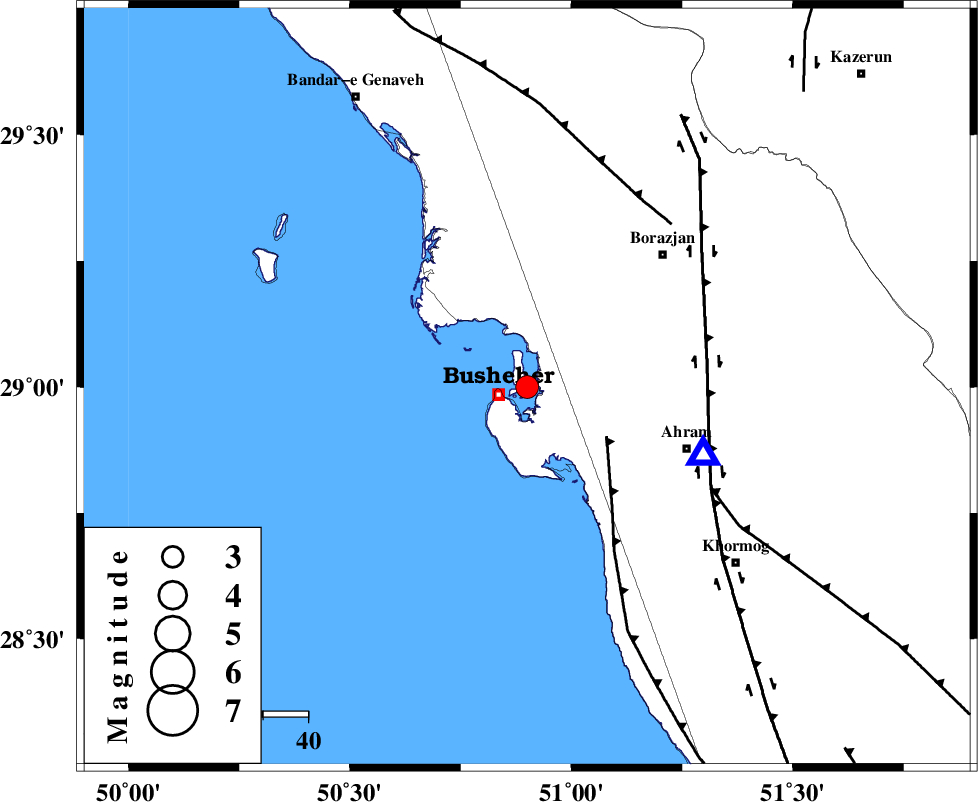
| Location | Lat:29 Lon: 50.9 |
| Region | Persian Gulf, 6 km Busheher |
Nearest Cities |
|
| 6 km North of Busheher, Bushehr Province | |
| 13 km North West of Choghadak, Bushehr Province | |
| 30 km South of Kareband, Bushehr Province | |
| 31 km North West of Delvar, Bushehr Province | |
| 33 km South of Shabankareh, Bushehr Province | |
| Depth | 24 km |
| Agency | |
Faults within 150 km: |
|
| ZFF2 (Length: 84 km) , Distance to epicenter: 20 km | |
| BORAZJAN_F (Length: 168 km) , Distance to epicenter: 40 km | |
| MFF5 (Length: 74 km) , Distance to epicenter: 46 km | |
| Number of Phases | 5 |
| RMS | 0.1 |
| Number of Stations | 4 |
| Error in Latitude | >9.6 km |
| Error in Longitude | 7.8 km |
| Error in Depth | 6.5 km |
Download waveform in seisan format
to download seisan software Click here
to access information about IIEES stations Click here
Amplitude | ||||||||
| UID | Agency | Station | Component | Amplitude | Period | Arrival Time | Proccessing Time | Signal Clip |
| 90862 | IIEES | AHRM | E | 2368.8 | 0.43 | 2013-10-27 09:26:49 | 2013-10-27 10:46:00 | n |
| 90863 | IIEES | KRBR | E | 15.4 | 0.36 | 2013-10-27 09:29:06 | 2013-10-27 10:46:00 | n |
Phase | ||||||||||||
| Agency | Station | Component | Phase Type | Phase Quality | First Motion | Observed Arrival Time | Time Residual | Loc. Flag | Input Weight | Distance | Azimuth | |
| IIEES | AHRM | Z | Pg | E | 2013-10-27 09:26:40 | 0 | y | 42.1 | 111 | |||
| IIEES | AHRM | N | Sg | E | 2013-10-27 09:26:46 | -0.01 | y | 42.1 | 111 | |||
| IIEES | YZKH | Z | Pn | E | 2013-10-27 09:27:43 | -0.02 | y | 516 | 42 | |||
| IIEES | KRBR | Z | Pn | E | 2013-10-27 09:27:51 | 0.12 | y | 579 | 78 | |||
| IIEES | ZHSF | Z | Pn | E | 2013-10-27 09:28:38 | -0.25 | y | 962 | 84 | |||