
Magnitude |
3.2 |
| Date & Time (UTC) | 2013-10-27 17:51:43.5 |
| Date & Time (Local) | 1392/8/5 21:21:43.5 |
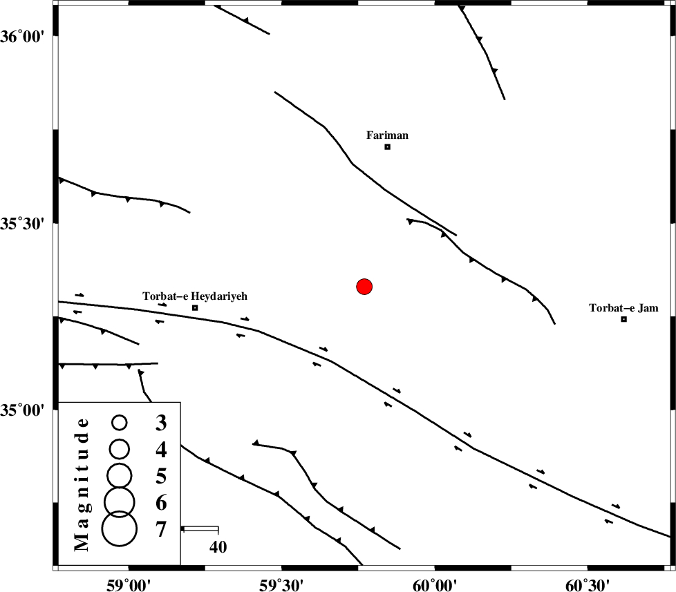
| Location | Lat:35.33 Lon: 59.77 |
| Region | Khorasan(center) Province, 42 km South of Fariman |
Nearest Cities |
|
| 9 km North of Choqmaq, Khorasan(center) Province | |
| 30 km South of Zarlag, Khorasan(center) Province | |
| 33 km West of Karizun, Khorasan(center) Province | |
| 34 km South West of Galandarabad, Khorasan(center) Province | |
| 35 km North East of Karizak-e nagahani, Khorasan(center) Province | |
| Depth | 42 km |
| Agency | |
Faults within 150 km: |
|
| TORBAT_E_JAM_F2 (Length: 57 km) , Distance to epicenter: 24 km | |
| DORUNEH_F (Length: 713 km) , Distance to epicenter: 24 km | |
| TORBAT_E_JAM_F1 (Length: 71 km) , Distance to epicenter: 27 km | |
| Number of Phases | 7 |
| RMS | 0.1 |
| Number of Stations | 4 |
| Error in Latitude | >2.8 km |
| Error in Longitude | 2.2 km |
| Error in Depth | 2.5 km |
Download waveform in seisan format
to download seisan software Click here
to access information about IIEES stations Click here
Amplitude | ||||||||
| UID | Agency | Station | Component | Amplitude | Period | Arrival Time | Proccessing Time | Signal Clip |
| 90864 | IIEES | SHRT | E | 231.2 | 0.24 | 2013-10-27 17:52:40 | 2013-10-27 06:33:00 | n |
| 90865 | IIEES | SHRT | N | 273.6 | 0.28 | 2013-10-27 17:52:40 | 2013-10-27 06:33:00 | n |
Phase | ||||||||||||
| Agency | Station | Component | Phase Type | Phase Quality | First Motion | Observed Arrival Time | Time Residual | Loc. Flag | Input Weight | Distance | Azimuth | |
| IIEES | SHRT | Z | Pn | E | 2013-10-27 17:52:12 | 0.15 | y | 193 | 166 | |||
| IIEES | SHRT | E | Sg | E | 2013-10-27 17:52:37 | -0.07 | y | 193 | 166 | |||
| IIEES | TABS | Z | Pn | E | 2013-10-27 17:52:26 | -0.14 | y | 307 | 233 | |||
| IIEES | TABS | N | Sg | E | 2013-10-27 17:53:08 | 0.08 | y | 307 | 233 | |||
| IIEES | BSRN | Z | Pn | E | 2013-10-27 17:52:35 | 0.01 | y | 378 | 189 | |||
| IIEES | BSRN | E | S | E | 2013-10-27 17:53:13 | -0.01 | y | 378 | 189 | |||
| IIEES | YZKH | Z | Pn | E | 2013-10-27 17:53:00 | -0.03 | y | 580 | 237 | |||

 IIEES All Rights Reserved