
Magnitude |
4 |
| Date & Time (UTC) | 2013-11-05 18:24:14.9 |
| Date & Time (Local) | 1392/8/14 21:54:14.9 |
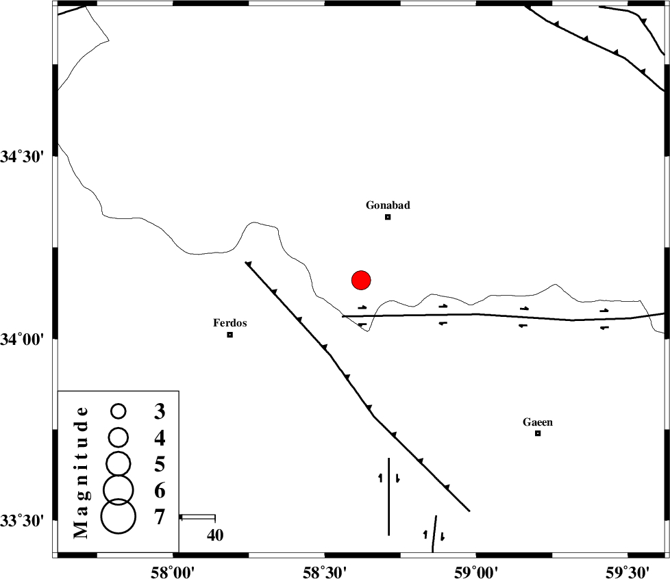
| Location | Lat:34.16 Lon: 58.62 |
| Region | Khorasan(center) Province, 21 km South of Gonabad |
Nearest Cities |
|
| 1 km North of Kakhak, Khorasan(center) Province | |
| 6 km North of Marghash, Khorasan(center) Province | |
| 20 km South East of Zibod, Khorasan(center) Province | |
| 20 km North East of Masbaei, Khorasan(center) Province | |
| 21 km South of Gonabad, Khorasan(center) Province | |
| Depth | 14 km |
| Agency | |
Faults within 150 km: |
|
| DASHT_E_BAYAZ_F (Length: 177 km) , Distance to epicenter: 12 km | |
| FERDOWS_F (Length: 101 km) , Distance to epicenter: 25 km | |
| DUSTABAD_F (Length: 22 km) , Distance to epicenter: 55 km | |
| Number of Phases | 5 |
| RMS | 0.1 |
| Number of Stations | 5 |
| Error in Latitude | >4.8 km |
| Error in Longitude | 1.9 km |
| Error in Depth | 3.6 km |
Download waveform in seisan format
to download seisan software Click here
to access information about IIEES stations Click here
Amplitude | ||||||||
| UID | Agency | Station | Component | Amplitude | Period | Arrival Time | Proccessing Time | Signal Clip |
| 90923 | IIEES | TABS | N | 1719 | 0.48 | 2013-11-05 18:25:01 | 2013-11-05 06:47:00 | n |
| 90924 | IIEES | SHRT | E | 2423.9 | 0.4 | 2013-11-05 18:25:07 | 2013-11-05 06:47:00 | n |
| 90925 | IIEES | SHRT | N | 3488 | 0.4 | 2013-11-05 18:25:07 | 2013-11-05 06:47:00 | n |
Phase | ||||||||||||
| Agency | Station | Component | Phase Type | Phase Quality | First Motion | Observed Arrival Time | Time Residual | Loc. Flag | Input Weight | Distance | Azimuth | |
| IIEES | TABS | Z | Pg | E | 2013-11-05 18:24:39 | -0.1 | y | 150 | 248 | |||
| IIEES | SHRT | Z | Pg | E | 2013-11-05 18:24:42 | -0.01 | y | 165 | 110 | |||
| IIEES | BSRN | Z | Pn | E | 2013-11-05 18:24:53 | 0.01 | y | 248 | 169 | |||
| IIEES | YZKH | Z | Pn | E | 2013-11-05 18:25:15 | 0.09 | y | 423 | 244 | |||
| IIEES | GHVR | Z | Pn | E | 2013-11-05 18:25:47 | 0.05 | y | 680 | 275 | |||